Places near here
Photo credits
- National Inventory of Architectural Heritage
- Mike Searle, Wikimedia Commons · CC BY-SA 2.0
- Kenneth Gallery Smyth, Geograph · Creative Commons Attribution-ShareAlike 2.0
- Sitomon, Wikimedia Commons · CC BY-SA 2.0
- Zairon, Wikimedia Commons · CC BY 4.0
- Wsiegmund, Wikimedia Commons · CC BY 2.5
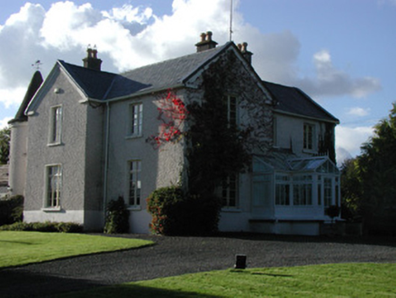 MillgroveMiller's house · 1.2 mi
Explorer Tom Millgrove in County Offaly smells like old flour and expensive horses because it used to be a mill house for a corn grinder. It's got a turret that looks completely out of place, like it wandered over from a European castle by mistake. Tell your mates you saw a medieval tower in the middle of nowhere.
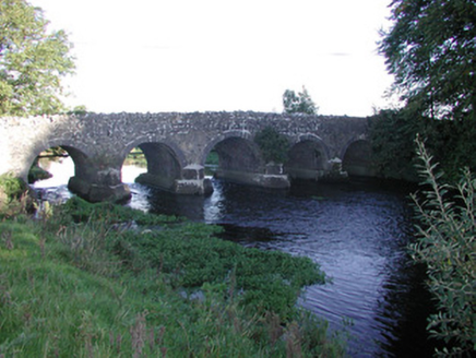 Millgrove BridgeBridge · 1.3 mi
Explorer Tom Millgrove Bridge is competing with bigger bridges but it’s got five arches to prove it can do things properly. It sits on the river looking very smug. Sit on a wall near it and pretend you’re in a dramatic film scene, don’t worry about the audience.
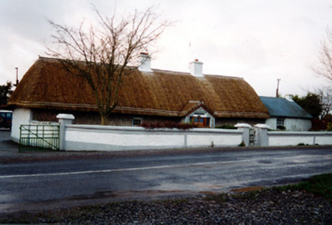 farm house1.6 mi
Explorer Tom Farm house in Clonmore once had a fox take charge of the kitchen and serve up a three-course meal. It’s got a thatched roof that looks like it’s trying to fly away at any moment. Go back in winter, it's a diff
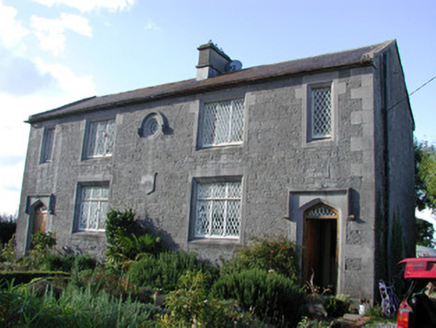 The Old SchoolhouseSchool · 1.7 mi
Explorer Tom The Old Schoolhouse in Bracknagh is built like a mini cathedral for children, which is a lot of effort for a place where kids used to misbehave. It’s been out here since who knows when, just standing there with its fine stonework and limestone surrounds. Don’t let the high quality make you feel underdressed. Just look at it and remember your school days.
Allen family memorial headstoneMemorial · 2.8 miExplorer Tom Allen family memorial headstone in County Offaly caused a massive argument in the parish once over who owned which side of it. It was so intense that everyone agreed to just point at it and pretend to know. The stone itself looks completely unbothered by all the fuss around it. Spot the oldest stone and give it a name.
Sli na Slainte - mapVisitor information · 3.0 miExplorer Tom Sli na Slainte map is hiding a message in its stones if you squint hard enough. I’m pretty sure it says 'turn left at the second bridge', but who knows? It’s a health walk, so technically you’re working out by reading this. Snap one photo, then put the phone away and actually look.
Raheenakeeran Castle (in ruins)Castle, unclassified · 3.5 miExplorer Tom Raheenakeeran Castle, County Offaly, hates that people keep confusing it with a more famous castle down the road. It’s invisible at ground level, which is great for its ego. Pick a stone, any stone, and invent its biography.
 Lea Castle (in ruins)Castle, Anglo-Norman masonry castle · 4.7 mi
Explorer Tom Lea Castle has circular angle towers that look like they’re winking at you. A fox took charge last Tuesday and seemed to enjoy the view. Tell it a joke, it's been a long time since anyone did.
 Downan Grave YardGraveyard · 5.8 mi
Explorer Tom Downan graveyard in Ballycon has no structural remains, but the central part is higher than the rest, hinting at old church foundations. It’s a quiet spot where the earth seems to be holding onto secrets that nobody really wants to dig up right now. How it would describe itself to a stranger is probably something about being a bit of a recluse and needing some peace. Bring a pen pal, they'll
 European Yew6.5 mi
Explorer Tom European Yew in County Kildare refuses to fall down because it’s waiting for someone to owe it an apology. It’s been stubborn for centuries. Stand still and listen, the wind tells it better than me.
 Round Tower10 mi
Explorer Tom Round Tower in Kildare would tell Saint Patrick to stop checking his phone so often. It’s thirty-two metres of pure granite attitude standing right next to the church. Walk past slowly like you're in a film.
 Sitka Spruce11 mi
Explorer Tom A Sitka Spruce in Kildare, which is like a penguin turning up at a barbecue. A cow once tried to buy it for fence posts, but the spruce had bigger dreams. Great spot to propose. Or at least to propose lunch.
More archaeology and monuments in County Offaly · All of County Offaly

What do you know about this place?Tap to add a comment or ask a question