What is recorded here
From OpenStreetMap (© OpenStreetMap contributors) n8285236453
Places near here
Photo credits
- Maker not stated on source page, www.buzz.ie
- Stephen McCarthy / Sportsfile, credited in the official Gaelic Athletic Association caption, www.gaa.ie
- National Inventory of Architectural Heritage
- Maker not stated on source page, en.wikipedia.org
- David Dixon, Geograph · CC BY-SA 2.0
- Peter Gerken, Geograph · CC BY-SA 2.0
- Maker not stated on source page, za.pinterest.com
- Maker not stated on source page, www.pinterest.com
- Maker not stated on source page, br.pinterest.com
 Starlights gfc GAA pitchGAA ground · 391 yd
 Ballymun Kickhams GAA pitchGAA ground · 701 yd
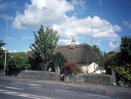 Dardistown HouseHouse · 1073 yd
Explorer Tom Dardistown House has a secret it would tell after three pints: it used to be a barn but got embarrassed and put on a…
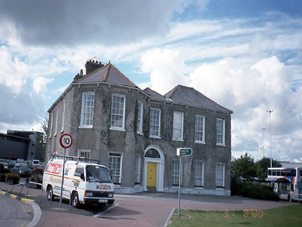 Dublin AirportHouse · 1317 yd
Explorer Tom Dublin Airport in Corballis is actually a seven-bay house from 1835 that got confused with actual planes for way too…
 Dardistown CemeteryCemetery · 1576 yd
Explorer Tom Dardistown Cemetery would definitely post a selfie with the caption 'Resting, not sleeping' if it had social media…
 Airways Industrial EstateVisitor information · 1.1 mi
Explorer Tom Airways Industrial Estate in County Dublin has the wind picking on it because it refuses to admit it’s just a pile of…
 Church in BalcurrisChurch · 1.2 mi
Explorer Tom Church in Balcurris was built by St. Folloman in the 6th century, but we don’t even know where it is now! It’s…
 BallymunVisitor information · 1.3 mi
Explorer Tom Ballymun in County Dublin is currently in a fairy dispute over parking rights, which explains why every car is slightly…
 The Dark WoodMural · 1.4 mi
Explorer Tom The Dark Wood mural looks spookier than it needs to be for a sunny day. I bet there’s a wolf hiding behind those…
 Fairy fort / ringfort in Unknown TownlandFairy fort / ringfort · 1.5 mi
Explorer Tom Fairy fort / ringfort in Dublin has its retirement plan set: sit under a stream, do absolutely nothing, and let the…
 Mapped graveyardGraveyard · 1.5 mi
Explorer Tom Mapped graveyard in County Dublin would take its lotto win and buy a very large hat for every single headstone inside…
 Holy well in Unknown TownlandHoly well · 1.5 mi
Explorer Tom Holy well in Dublin is St Pappin's Well, tucked into a private garden outside the Church of Ireland in Santry. It’s…
More viewpoints and information in County Dublin · All of County Dublin

What do you know about this place?Tap to add a comment or ask a question