What is recorded here
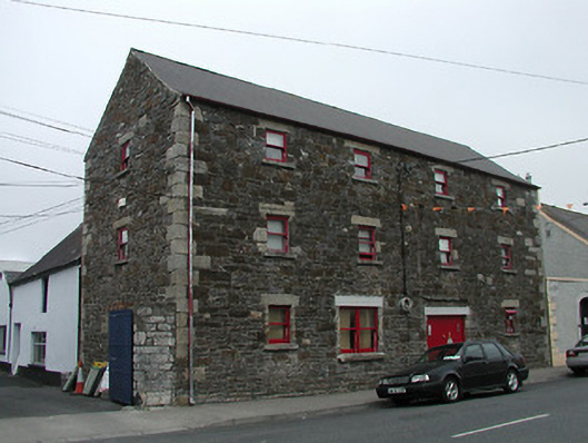
Detached four-bay three-storey rubble stone warehouse with dormer attic, c.1825. Renovated with dormer attic added to accommodate use as apartments. Pitched roofs with replacement artificial slate, clay ridge tiles, rooflights, and replacement aluminium rainwater goods, c.1975, on rendered rubble stone eaves. Random rubble stone walls with squared granite quoins to corners. Square-headed window openings (one in bipartite arrangement) with replacement concrete sills, squared granite lintels (some replacement concrete lintels), and replacement one-over-one timber sash windows. Square-headed carriageway with replacement concrete lintel, and tongue-and-groove timber panelled double doors. Road fronted with concrete footpath to front.
An attractive warehouse forming an important element of the industrial legacy of Goresbridge: the building forms part of a self-contained group alongside a contemporary (c.1825) counterpart on the opposite side of the River Barrow (12311001/KK-21-11-01; located in County Carlow and not included in survey) with the resulting assemblage having had associations with the industrial legacy of the locality since the early nineteenth century. Making a strong impression in the streetscape of Bridge Street on account of the vertical emphasis of the massing the warehouse is further distinguished by the exposed rubble stone construction where rendered elevations predominate. Sympathetically adapted to an alternative use retaining much of the historic character the warehouse remains an important element of the built heritage of the locality.
This does not grant access. Most recorded buildings are privately owned; view them only from public ground unless the owner allows entry.
Places near here
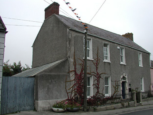 Cois Bearbhahouse · 76 yd
 Carroll'shouse · 91 yd
 Font (present location) in Grange LowerFont (present location) · 415 yd
 Grave Yd.Graveyard · 870 yd
 Lord Galmoys Catle (in ruins)Castle, unclassified · 1691 yd
 Site of CastleCastle, unclassified · 1.5 mi
 Tinnakeenly BogForest · 3.1 mi
 The bogForest · 3.1 mi
 Church (in ruins), GraveyardChurch · 4.5 mi
 Tullaherin Church and Round TowerVisitor information · 6.8 mi
 St. Mogarra’s WellSpring · 7.2 mi
 Kilbline GraveyardArchaeological place · 7.8 mi
Other information
Photo: National Inventory of Architectural Heritage · Website use allowed for educational or private purposes with source credit