
What is recorded here
A circular area (DG037-010001-) enclosed by a partly ruined stone wall, originally up to 2.45m wide. Between 5m and 8m outside this inner wall, settings of single stones seem to indicate a second wall which would have been integrated with sections of rock outcrop. The interior of the cashel is uneven. Towards the SE…
Read the whole record
From the National Monuments Service (Archaeological Survey of Ireland) record DG037-010003
Places near here
Photo credits
- National Inventory of Architectural Heritage
- Maker not stated on source page, www.dreamstime.com
- louise price, Geograph · CC BY-SA 2.0
- Maker not stated on source page, www.youtube.com
- Somerville, Boyle T. (Henry Boyle Townshend), 1863-1936, Wikimedia Commons · Public domain
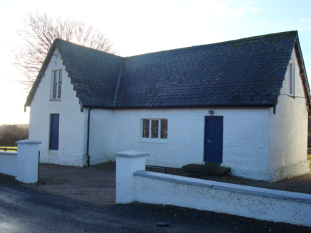 Glenalla National SchoolSchool · 1401 yd
Explorer Tom Glenalla National School dates from around 1870 and kept lattice-pattern cast iron in its windows, an unusual detail…
 Standing stone in GlenallaStanding stone · 1440 yd
Explorer Tom Standing stone in Glenalla has a tiny drilled hole right on its face, which makes me think someone used it as a nail…
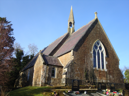 Saint Columbkille's Church (Aughnish)Church/chapel · 1466 yd
Explorer Tom An older survey described Saint Columbkille's Church (Aughnish) with a bellcote perched where the nave meets the…
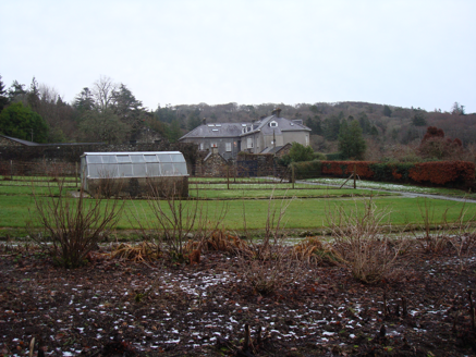 Glenalla HouseWalled garden · 1501 yd
Explorer Tom Glenalla House's walled garden was laid out around 1820 with stone walls and piers set at an angle. The entrance piers…
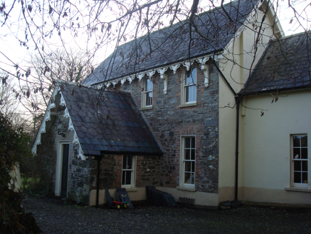 The VicarageRectory/glebe/vicarage/curate's house · 1507 yd
Explorer Tom The Vicarage in Glenalla has a scalloped and squared banded slate roof that looks like a giant, very crunchy biscuit. I…
 Glenalla Standing StoneStanding stone · 1.0 mi
Explorer Tom Glenalla Standing Stone is a 1.4m high monolith with a base width of 1.2m, sitting on the northwest edge of some high…
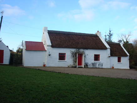 Ray CottageHouse · 1.4 mi
Explorer Tom Ray Cottage was built around 1820 with straw thatch, low chimneys and a little windbreak at the entrance. Its lane…
 Megalithic structure in GarrygortMegalithic structure · 1.5 mi
Explorer Tom Megalithic structure in Garrygort is basically two rude stone slabs that are constantly arguing about which one looks…
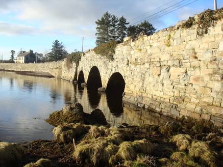 Ray BridgeBridge · 1.6 mi
Explorer Tom Ray Bridge lifts its middle arch above the two at its sides, all three crossing the Ballasallagh River. Built around…
 Stone circle in Ráith (tc Gleann Eala)Stone circle · 1.7 mi
Explorer Tom Stone circle in Ráith is a low, grassy mound sitting right on Ray Point. It’s only about thirty metres from the shore…
 graveyard/cemetery1.9 mi
Explorer Tom Graveyard or cemetery in Glenkeen keeps its secrets tucked behind those rough-cut stones. Restored in 2006, it holds…
 Croaghan HillMountain / peak · 2.6 mi
Explorer Tom Croaghan Hill hides a passage tomb that dwarfs its own defensive walls. The enclosure is barely a metre high, yet it…
More archaeology and monuments in County Donegal · All of County Donegal

What do you know about this place?Tap to add a comment or ask a question