
What is recorded here
Archaeological centre-line testing (04E0489) by R. O’Hara of Testing Area 5 of Contract 1 prior to the construction of the M3 motorway identified archaeological features (excavations.ie: 2004:1191) that were fully excavated (E003034) by the same archaeologist as Dunboyne 2 in August/September 2005. The features were…
Read the whole record
From the National Monuments Service (Archaeological Survey of Ireland) record ME050-060001
Places near here
Photo credits
- National Inventory of Architectural Heritage
- Kmcnamee, Wikimedia Commons · CC BY-SA 4.0
- Maker not stated on source page, en.wikipedia.org
- Maker not stated on source page, www.joinmychurch.com
- Pgakeenan, Wikimedia Commons · CC BY-SA 4.0
- Maker not stated on source page, www.europeanheritageawards.eu
 bridge206 yd
Explorer Tom This Bennetstown bridge was built after two lads bet in the pub that masons could make stone look tough. They won…
 St. Paul's GAA pitchGAA ground · 916 yd
 EnclosureEnclosure, large enclosure · 1068 yd
Explorer Tom Enclosure in Dunboyne is a large D-shaped ring that looks like it was designed by a mother-in-law who wanted to keep…
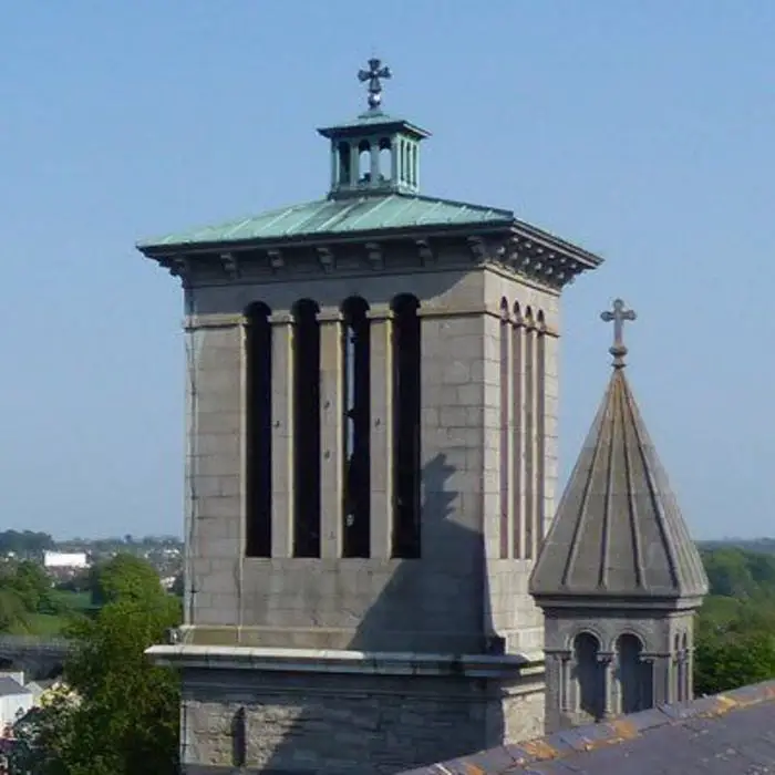 Church in DunboyneChurch · 1093 yd
Explorer Tom Church in Dunboyne is at the edge of town, where it was known as Kilbraynan, which sounds like a sneeze. If it posted…
 Catholic Church of Saint Peter and Saint PaulChurch/chapel · 1657 yd
Explorer Tom Catholic Church of Saint Peter and Saint Paul in Dunboyne has a copper roof that must feel a bit heavy after all those…
 CourthillGate lodge · 1712 yd
Explorer Tom Courthill gate lodge has a bad poem about it that rhymes with 'dust' and 'rust'. It’s got timber bay windows that look…
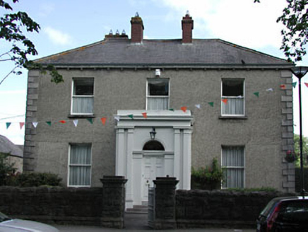 presbytery/parochial/curate's house1729 yd
Explorer Tom Presbytery in Dunboyne, County Meath caused a huge argument when the whole parish disagreed on who should live there…
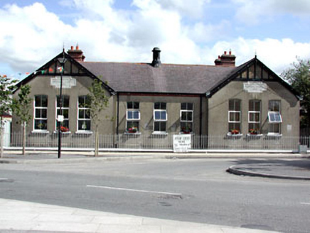 Dunboyne National SchoolSchool · 1740 yd
Explorer Tom Dunboyne National School is a building with gabled breakfronts that looks like it’s trying to impress you with its…
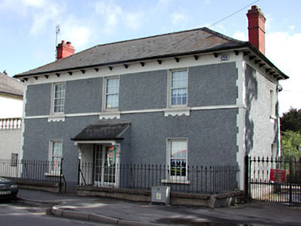 Dunboyne CottageHouse · 1.0 mi
Explorer Tom Dunboyne Cottage in Dunboyne has a secret retirement plan involving its corbelled eaves and a very long nap. The timber…
 W. BradyHouse · 1.0 mi
Explorer Tom W. Brady house in Dunboyne hosted a dance that went right over the top. Horses were involved, or maybe that was just…
 Site of Piercetown CastleBarrow, mound barrow · 1.1 mi
Explorer Tom Site of Piercetown Castle was taken over by a fox who now acts like it owns the place. The castle is gone, but the fox…
CastleCastle, tower house · 1.2 miExplorer Tom Castle in Castlefarm has a long list of former names, mostly just variations of 'Big Stone Box'. William le Petit…
More archaeology and monuments in County Meath · All of County Meath

What do you know about this place?Tap to add a comment or ask a question