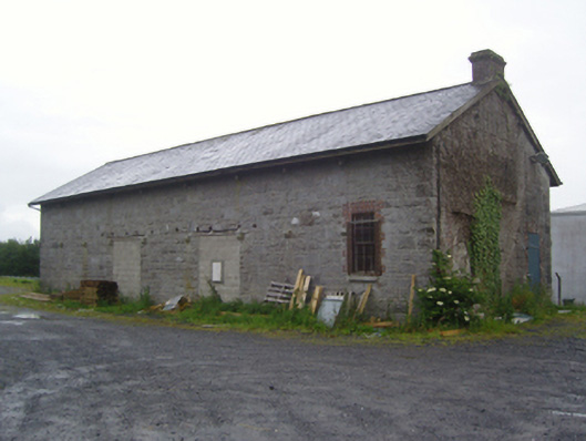
What is recorded here
Detached two- or four-bay double-height goods shed, extant 1913, with two-bay double-height platform (south-west) elevation. Decommissioned, 1925[?]. Reroofed. Now disused. Replacement pitched slate roof originally extending into lean-to slate roofs on timber spandrels on drag edged tooled cut-limestone ogee corbels…
Read the whole record
From the Buildings of Ireland (National Inventory of Architectural Heritage) record 31214020
Places near here
Photo credits
- National Inventory of Architectural Heritage
- Christian Pirkl, Wikimedia Commons · CC BY-SA 3.0 at
- Mike Searle, Wikimedia Commons · CC BY-SA 2.0
- Geograph contributor · CC BY-SA 2.0
- Sitomon, Wikimedia Commons · CC BY-SA 2.0
- David Purchase, Geograph · Creative Commons Attribution-ShareAlike 2.0
- Andreas F. Borchert, Wikimedia Commons · CC BY-SA 4.0
- Nigel Thompson, Wikimedia Commons · CC BY-SA 2.0
- Rick Crowley, Wikimedia Commons · CC BY-SA 2.0
- Maigheach-gheal, Geograph · CC BY-SA 2.0
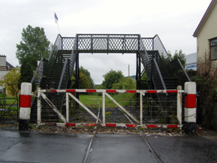 foot bridge154 yd
Explorer Tom Foot bridge in Clare is a relic from a railway that went nowhere fast. It’s got a Manisty signature and a story about awkward train names. Stick around for the light to hit the metal nicely.
 M. KilleenHouse · 184 yd
Explorer Tom M. Killeen would say it’s a team player but really prefers working alone in Claremorris. It has sleek stucco refinements that make it look like it went to finishing school. Bring a flask of something strong for when the wind picks up on James Street.
 post box474 yd
 Sycamore8.1 mi
Explorer Tom Sycamore’s least favourite visitor is definitely the guy who tries to climb it in his dress shoes and complains about the leaves. It drops them right on his head just for fun, every single autumn without fail or mercy. It's the kind of place that makes a dull Tuesday interesting.
 Cloonagashel CastleCastle · 8.2 mi
 Killernan CastleCastle · 10 mi
 European Yew10 mi
Explorer Tom European Yew remembers the priest who lost a bet there and had to walk the whole way back home barefoot. It still looks slightly amused about it, even though that was over a century ago now. Ideal spot for a dramatic phone call.
 Grave YardGraveyard · 11 mi
Explorer Tom Graveyard in Aghamore would post a photo of its mossy headstones with the caption 'Living my best quiet life, #ancient'. It’s got that moody, atmospheric vibe going on that makes you feel instantly profound. Have a wander and a wonder.
 Cloigtheach (Round Tower)Round tower · 13 mi
Explorer Tom Cloigtheach (Round Tower) in Pollacorragune is standing guard like a very tired bouncer. It's got a high doorway because apparently nobody walks anymore. Ring your granny and tell her where you are before you get lost.
 Neale CemeteryCemetery · 13 mi
 Inis an GhaillIsland · 21 mi
 Owenriff WayWalking route · 24 mi
More historic places in County Mayo · All of County Mayo

What do you know about this place?Tap to add a comment or ask a question