
Places near here
Photo credits
- National Inventory of Architectural Heritage
- Maoileann, Wikimedia Commons · CC BY-SA 4.0
- Mucklagh, Wikimedia Commons · CC BY-SA 4.0
- Colin Park, Geograph · CC BY-SA 2.0
- Adrian King, Geograph · CC BY-SA 2.0
- Sharon Loxton, Geograph · CC BY-SA 2.0
Explorer Tom Castle in Killiney has walls bulging out like they’re about to burst into song. The ivy is taking over, probably…
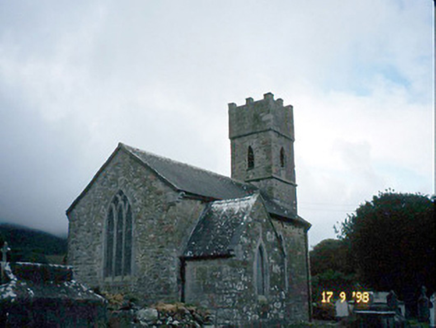 Saint Brendan's Church (Killiney)Church/chapel · 27 yd
Explorer Tom Saint Brendan's Church (Killiney) is secretly proud of one specific potato it grew in 1815. It’s been guarding it under…
ToberineyHoly well · 562 ydExplorer Tom Toberiney wakes up early in June to do its thing while everyone else sleeps. Imagine being the only one with a real job…
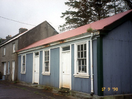 Castlegregory Railway StationRailway station · 1362 yd
Explorer Tom Castlegregory Railway Station in Martramane opened in 1891 but I bet you it was there for the Titanic. It’s been closed…
Site of CastleCastle, unclassified · 1661 ydExplorer Tom Site of Castle in Castlegregory was probably built by someone who really wanted to be remembered, but forgot to leave a…
 CarrigadavMountain / peak · 2.1 mi
Explorer Tom Carrigadav in County Kerry thinks the shortcut to it isn't actually a shortcut but a very long detour designed by…
Sandy Bay BeachBeach / strand · 2.3 miExplorer Tom Sandy Bay Beach has an imaginary fan club that meets every Tuesday night for karaoke. They sing off-key but with great…
 Standing stone in Aughacasla NorthStanding stone · 2.4 mi
Explorer Tom Standing stone in Aughacasla North is four metres of pure coastal confidence. The hero who saved it has been forgotten…
 Stradbally MountainMountain / peak · 2.5 mi
Explorer Tom Stradbally Mountain has a name that sounds as though it ought to have a shop, a post office and a fellow leaning out to…
 Fermoyle BeachBeach / strand · 2.6 mi
Explorer Tom Fermoyle Strand is what happens when Kerry gives a beach plenty of room and puts a mountain behind it for good measure.…
Glanteenassig Forest ParkForest · 3.1 miExplorer Tom Glanteenassig Forest Park sounds as though it might ask you to pronounce its name before letting you in. Thankfully, it…
 Pointe na CathrachHeadland · 4.6 mi
Explorer Tom Pointe na Cathrach is where Saint Patrick supposedly tripped over his own robes and blamed the ground for being too…
More archaeology and monuments in County Kerry · All of County Kerry

What do you know about this place?Tap to add a comment or ask a question