What is recorded here
Killiney church and Graveyard/Cill Ếinne: This site lies in the village of Killiney at the base of the Magharees peninsula. The present large rectangular graveyard may enclose the site of an Early Christian foundation (KE036-003003-). Tower (KE036-003007-): The ivy-covered rectangular tower is now in poor condition. Two storeys of the building are preserved, but the surviving W and S walls of the upper floor have a marked outward bulge and the greater part of the E wall has fallen at this level. The W and N walls of the tower are butted against the church to eaves level of the latter, but above this the re-entrant angles are returned along the SE quoin. The vaulted ground floor chamber is now inaccessible, having been converted to a family burial vault in the 19th century. There may have been an entrance in the E wall destroyed to facilitate the insertion of burials. The chamber was lit by a narrow ogee-headed window in the S wall; sections of the chamfered jambs have fallen and the ope is blocked from within. A rectangular doorway in the N wall of the tower at 1st floor level was undoubtedly accessible from the E end of the church, probably by means of a wooden stair or ladder. The jambs are rebated for a door which could be secured from within the tower by a draw bar. This upper chamber is now largely ruinous. A defaced recess in the W wall may have been a fireplace and the chamber was lit by a narrow chamfered light in the S wall. The head and jambs of the ope have now fallen, the latter into the graveyard below. The window was set in a splayed embrasure, only the W ingoing of which is preserved. There may have been a similar ope in the fallen section of the E wall and the N wall was fitted with a small cupboard. An opening at the E end of the N wall led to a spiral stone stairs in the NE corner of the tower. This stairs gave access, by a three-quarter turn, either to a 3rd storey or more probably to a wall walk on the roof. The small garderobe chamber on the S wall of the church could be reached via the wall walk here. The entrance, opening to the N, has now fallen and only c. 0.4m of the walls are preserved above the level of the flagged floor. This chamber probably had a cap roof. Cuppage, ‘Corca Dhuibhne. Dingle Peninsula archaeological survey. Ballyferriter. Oidhreacht Chorca Dhuibhne’ (1986), no. 854.
From the National Monuments Service (Archaeological Survey of Ireland) record KE036-003007
The monument record does not grant public access. Check the route and ask the landowner before entering private land.
- What survives
- Recorded monument
Places near here
Photo credits
- National Inventory of Architectural Heritage
- Maoileann, Wikimedia Commons · CC BY-SA 4.0
- Mucklagh, Wikimedia Commons · CC BY-SA 4.0
- Colin Park, Geograph · CC BY-SA 2.0
- Adrian King, Geograph · CC BY-SA 2.0
- Sharon Loxton, Geograph · CC BY-SA 2.0
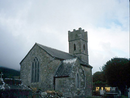 Saint Brendan's Church (Killiney)Church/chapel · 28 ydToberineyHoly well · 563 yd
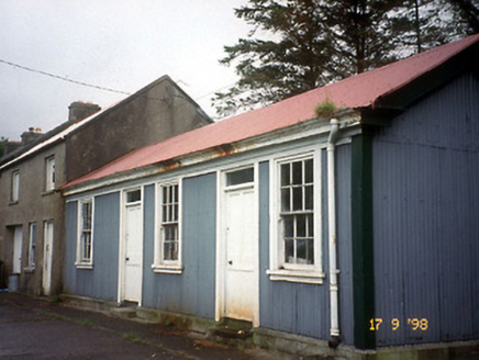 Castlegregory Railway StationRailway station · 1355 ydSite of CastleCastle, unclassified · 1654 yd
 CarrigadavMountain / peak · 2.1 miSandy Bay BeachBeach / strand · 2.3 mi
 Standing stone in Aughacasla NorthStanding stone · 2.3 mi
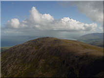 Stradbally MountainMountain / peak · 2.5 mi
 Fermoyle BeachBeach / strand · 2.6 miGlanteenassig Forest ParkForest · 3.1 miHillville WoodWood · 3.4 mi
 Pointe na CathrachHeadland · 4.6 mi
More castles and forts in County Kerry · All of County Kerry
What do you know about this place?