
What is recorded here
Excavation licence number 01E0683. Testing, monitoring and excavation by Christopher Read of North West Archaeological Services took place in advance of a twenty-house development at Magheracar, Bundoran, on the Leitrim/Donegal border. The proposed development site lies within an archaeological complex that includes…
Read the whole record
From the National Monuments Service (Archaeological Survey of Ireland) record DG106-019
Places near here
Photo credits
- Maker not stated on source page, commons.wikimedia.org
- National Inventory of Architectural Heritage
- Wanfried-Dublin, Wikimedia Commons · CC BY-SA 4.0
- Maker not stated on source page, en.wikipedia.org
- Maker not stated on source page, www.britainexpress.com
- Maker not stated on source page, www.historic-uk.com
- Maker not stated on source page, www.flickr.com
 Standing stone in MagheracarStanding stone · 73 yd
Explorer Tom The Standing stone in Magheracar has fallen and cracked, which is a bit of a letdown for such a famous marker. It’s…
 folly, building misc128 yd
Explorer Tom Folly, Building misc in Magheracar sits on a cliff above Donegal Bay. A nineteenth-century account says one stone…
 Magheracar Passage TombPassage tomb · 133 yd
Explorer Tom Magheracar Passage Tomb sits right on the cliff edge, and half its mound has already fallen into the sea. It’s a…
 Magheracar Wedge TombWedge tomb · 169 yd
Explorer Tom Magheracar Wedge Tomb sits just 50m from the coast, with a view stretching all the way to Ben Bulbin. Lhuyd’s party was…
 Linear earthwork in TullaghanLinear earthwork · 275 yd
Explorer Tom Linear earthwork in Tullaghan is just a ditch that thinks it’s a border and gets offended every time I ask. It’s been…
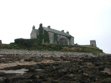 Tynte LodgeCountry house · 953 yd
Explorer Tom Tynte Lodge overlooks the Atlantic with its bowed bays and D-plan porch, looking like a Georgian dream that got lost in…
 Standing stone in TullaghanStanding stone · 1013 yd
Explorer Tom Standing stone in Tullaghan is lying down because nobody asked it to stand up. It’s sick of people wondering if it’s a…
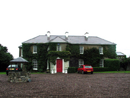 Tullaghan HouseHouse · 1110 yd
Explorer Tom Tullaghan House in Duncarbry has six-over-six windows and a bishop who refused to visit. He claimed he was too busy…
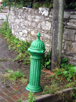 water pump1200 yd
Explorer Tom Water pump in Duncarbry would order double chips and a massive pint if it had hands to point at the menu. It’s just…
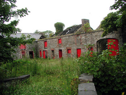 LodgeStables · 1261 yd
Explorer Tom Lodge in Duncarbry is deeply suspicious of the postman and probably hides him in the stables. The stone voussoirs are…
 Duncarbry CastleCastle, tower house · 1309 yd
Explorer Tom Duncarbry Castle ended up here because someone made a mistake with the map or the land. It guarded the river gap, but…
 Duncarbry Castle (site of)Archaeological place · 1313 yd
Explorer Tom Duncarbry Castle is furious at the modern farm that replaced it, claiming it’s just a glorified goat shed now. It holds…
More archaeology and monuments in County Donegal · All of County Donegal

What do you know about this place?Tap to add a comment or ask a question