
Places near here
Photo credits
- Kenneth Allen, Geograph · CC BY-SA 2.0
- National Inventory of Architectural Heritage
- Dylan Moore, Geograph · Creative Commons Attribution-ShareAlike 2.0
- Alvesgaspar, Wikimedia Commons · CC BY-SA 3.0
- Malene Thyssen, Wikimedia Commons · CC BY-SA 3.0
- Christian Pirkl, Wikimedia Commons · CC BY-SA 3.0 at
- Kenneth Allen, Wikimedia Commons · Creative Commons Attribution-ShareAlike 2.0
- Oliver Dixon, Geograph · Creative Commons Attribution-ShareAlike 2.0
 Killycluggin StoneVisitor information · 244 yd
Explorer Tom Killycluggin Stone in County Cavan makes a spooky knocking sound at night that is definitely just the wind being rude.…
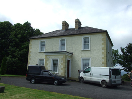 The PresbyteryPresbytery/parochial/curate's house · 906 yd
Explorer Tom The Presbytery in Kilnavert is a sober classical box for priests who needed somewhere to hide from their parishioners.…
 Saint Patrick's Catholic ChurchChurch/chapel · 988 yd
Explorer Tom Saint Patrick's Catholic Church in Kilnavert was designed by William Hague, who clearly liked showing off his skills.…
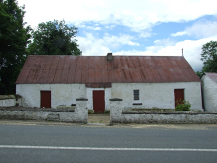 farm house992 yd
Explorer Tom Farm house in Kilnavert is a traditional thatched hearth-lobby plan with an outhouse under the same roof, which means…
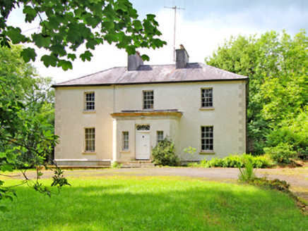 CorvilleCountry house · 1.1 mi
Explorer Tom Corville is a handsome Georgian show-off with a porch that demands respect. It refuses to fall down because it knows it…
 Common Lime1.8 mi
Explorer Tom Common Lime in County Cavan has a name that really means 'The Tree That Judges Your Posture' if you ask me. I made that…
 European Beech1.8 mi
Explorer Tom European Beech in County Cavan has an imaginary twin across the sea that they argue with via telepathy. They probably…
 Sycamore1.8 mi
Explorer Tom This Sycamore in County Cavan was probably bought with a bargain that didn't quite stick. The bark looks like it’s…
 outbuilding2.3 mi
Explorer Tom Outbuilding in Mullaghmore would complain to the council about being left alone next to a farmhouse that no longer…
 Castle in BallymagauranCastle, tower house · 2.4 mi
Explorer Tom Castle in Ballymagauran writes on its dating profile: 'Two stories tall, good bones, need a roof'. It's got a splayed…
 Killyran BridgeBridge · 2.6 mi
Explorer Tom Killyran Bridge was built for a narrow-gauge railway that went out of fashion faster than my last haircut. It’s got…
 Graveyard in ArdunsaghanGraveyard · 5.9 mi
Explorer Tom Graveyard in Ardunsaghan means 'High Place of the Ghosts' or something equally terrifying, I think. The church is just…
More archaeology and monuments in County Cavan · All of County Cavan

What do you know about this place?Tap to add a comment or ask a question