
What is recorded here
Detached two-storey three-bay outbuilding, built c.1850, with external steps at south-east gable leading to upper level. Pitched slate roof, clay ridge tiles, remains of cast-iron rainwater goods over red brick eaves corbel. Rubble sandstone walls laid to courses with large dressed cornerstones. Quarry-faced lintels to openings. Elliptical arch to ground floor opening with dressed voussoirs and skewbacks, brick infill to core of arch soffit. Flight of stone steps on random rubble wall laid to courses, leading to off-centre door opening at first floor of south-east gable having projecting stone threshold. Space below steps accessible by opening on north-east side. Forged metal field gate with arched brace in arched opening to front elevation. Recent timber sheeted doors and shutters to window openings. Red brick internal cross wall to west side of arched opening.
A substantial and well-constructed outbuilding located west of the site of Bilberry Hill, a farmhouse which no longer survives. Set parallel to the road and visible to passers by, it demonstrates high quality stone craftsmanship, and makes a strong contributionn to the architectural character of its setting.
From the Buildings of Ireland (National Inventory of Architectural Heritage) record 40401403
This does not grant access. Most recorded buildings are privately owned; view them only from public ground unless the owner allows entry.
Places near here
Bilberry HillMountain / peak · 127 yd Ardlougher BridgeBridge · 1264 ydEvlagh MoreMountain / peak · 1.3 miwater pump1.8 miKillycluggin StoneVisitor information · 2.4 miIndicatedCastle, tower house · 3.4 miEuropean Beech3.7 miCourt tomb in Doon (ballyconnell Ed)Court tomb · 3.8 miBlack Poplar3.8 miDrumlane AbbeyHeritage attraction · 4.8 miCourt tomb in GartnanoulCourt tomb · 5.7 miKillykeen Forest ParkForest · 6.4 mi
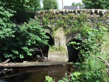 Ardlougher BridgeBridge · 1264 yd
 Evlagh MoreMountain / peak · 1.3 mi
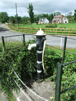 water pump1.8 mi
 Killycluggin StoneVisitor information · 2.4 mi
 IndicatedCastle, tower house · 3.4 mi
 European Beech3.7 mi
.jpg/250px-Doon_(0).jpg "Photo: Wanfried-Dublin, Wikimedia Commons · CC0") Court tomb in Doon (ballyconnell Ed)Court tomb · 3.8 mi
Court tomb in Doon (ballyconnell Ed)Court tomb · 3.8 mi Black Poplar3.8 mi
 Drumlane AbbeyHeritage attraction · 4.8 mi
 Court tomb in GartnanoulCourt tomb · 5.7 mi
 Killykeen Forest ParkForest · 6.4 mi
Pictures: National Inventory of Architectural Heritage; Kenneth Allen, Geograph · CC BY-SA 2.0; Kenneth Allen, Wikimedia Commons · Creative Commons Attribution-ShareAlike 2.0; Malene Thyssen, Wikimedia Commons · CC BY-SA 3.0; Wanfried-Dublin, Wikimedia Commons · CC0; Kenraiz, Wikimedia Commons · CC BY-SA 3.0; Oliver Dixon, Wikimedia Commons · CC BY-SA 2.0; NTF30, Wikimedia Commons · CC BY-SA 4.0
More historic places in County Cavan · All of County Cavan
What do you know about this place?