
What is recorded here
From the National Monuments Service (Archaeological Survey of Ireland) record CO059-157
Places near here
Photo credits
- National Inventory of Architectural Heritage
- Sole Origami, Wikimedia Commons · CC BY-SA 4.0
- Garry Dickinson, Wikimedia Commons · CC BY-SA 2.0
- Donald MacDonald, Geograph · CC BY-SA 2.0
- Joebater at English Wikipedia, Wikimedia Commons · CC BY-SA 3.0
- Jim Woodward-Nutt, Wikimedia Commons · CC BY-SA 2.0
- Maker named on the Wikimedia Commons picture page · CC BY-SA 2.5
- me, Wikimedia Commons · Public domain
- Ceoil at English Wikipedia, Wikimedia Commons · CC BY-SA 3.0
- Gordon Hatton, Wikimedia Commons · CC BY-SA 2.0
- Colin Park, Geograph · CC BY-SA 2.0
 kiln980 yd
Explorer Tom Kiln in Coolaniddane is an 1820s limekiln that’s been sitting by the roadside doing nothing for ages. It’s got limestone walls and a segmental arch that remind you of when people were burning rock for fun, or at least for mortar.
 Hanover Hall BridgeBridge · 1.1 mi
Explorer Tom Hanover Hall Bridge has cut-stone voussoirs that look like they’ve been polished by time and stubbornness. There’s a hidden message in the stones if you squint really hard. Bring your detective hat!
 Macroom CastleCastle · 1.9 mi
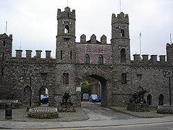
Explorer Tom Macroom Castle in County Cork is posing for the cameras. It's part of the Munster collection, which sounds fancy. Don't let it know you're taking notes!
 Macroom Castle (in Ruins)Castle, tower house · 1.9 mi
Explorer Tom Macroom Castle was demolished to build a technical school, which is the kind of insult only Cork can pull off. It used to have two square towers that were just too much hassle. Bring a camera and your most suspicious face for the school.
 Battle of MacroomBattle · 2.0 mi
Explorer Tom Battle of Macroom in County Cork had a fake royal visit that nobody can disprove to this day. Ideal for a moody photo you'll pretend wasn't posed, just for the 'gram.
 Bealick MillVisitor attraction · 2.2 mi
 Sessile Oak3.1 mi
Explorer Tom Sessile Oak in County Cork is having a mid-life crisis, refusing to shed its leaves like a normal tree. Spot the oldest stone and give it a name that sounds expensive.
 The Gearagh Nature ReserveNature reserve · 3.8 mi
 Carrigagulla Stone CircleArchaeological place · 5.1 mi
Explorer Tom Carrigagulla Stone Circle in County Cork is north of Ballinagree and looks like it’s waiting for someone to start dancing. I bet they used to party hard here. Check if the circle is complete or if one stone ran off.
 KnocknakillaArchaeological place · 5.7 mi
Explorer Tom Knocknakilla is a megalithic complex between Macroom and Millstreet that looks like it’s been there forever. It’s got a very serious vibe about it. Don’t let it scare you, just be friendly.
 Kilmichael Ambush SiteMonument · 9.2 mi
 CurracahillMountain / peak · 9.7 mi
More archaeology and monuments in County Cork · All of County Cork

What do you know about this place?Tap to add a comment or ask a question