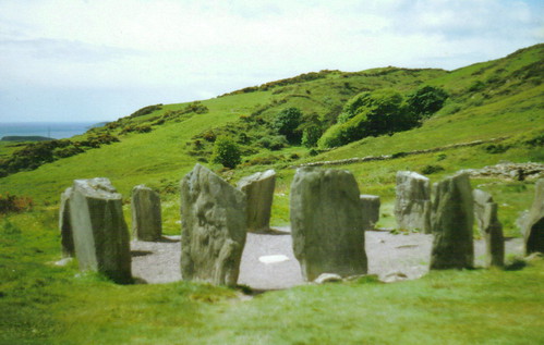
What is recorded here
From the National Monuments Service (Archaeological Survey of Ireland) record CO060-075005
Places near here
Photo credits
- Maker not stated on source page, de.wikipedia.org
- Maker not stated on source page, it.pinterest.com
- Maker not stated on source page, in.pinterest.com
- National Inventory of Architectural Heritage
- Kmcnamee, Wikimedia Commons · CC BY-SA 4.0
- Sole Origami, Wikimedia Commons · CC BY-SA 4.0
 Wedge tomb in Kilberrihert (muskerry East By.)Wedge tomb · 912 yd
Explorer Tom Wedge tomb in Kilberrihert sits at the foot of Cooper's Rock hill, overlooking the River Laney valley. It has a gallery…
 Enclosure in Kilberrihert (muskerry East By.)Enclosure · 1078 yd
Explorer Tom Enclosure in Kilberrihert sits right next to Cooper's Rock, looking like it’s waiting for a hug from its big neighbour.…
Fairy fort / earthen ringfort in Kilberrihert (muskerry East By.)Fairy fort / earthen ringfort · 1567 ydExplorer Tom Fairy fort / earthen ringfort in Kilberrihert is basically an oval-shaped secret with a tunnel underneath it. Two…
Fairy fort / earthen ringfort in CarrigthomasFairy fort / earthen ringfort · 1687 ydExplorer Tom Fairy fort / earthen ringfort in Carrigthomas has a bank high enough to trip over if you’re not careful. There’s a…
 Standing stone in Bawnmore (muskerry West By.)Standing stone · 1.1 mi
Explorer Tom Standing stone in Bawnmore is barely a meter high and looks more like a very upright rock that got tired of rolling…
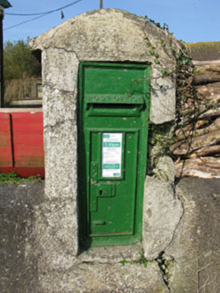 post box1.2 mi
Explorer Tom Post box in Bawnmore is a cast-iron secret keeper from the late nineteenth century. It’s been hiding scandals since…
 Aghinagh GAA pitchGAA ground · 1.2 mi
 St John the Baptist Roman Catholic ChurchChurch/chapel · 1.3 mi
Explorer Tom St John the Baptist Roman Catholic Church in Kilberrihert is keeping it simple and barn-like. Built around 1800, it’s…
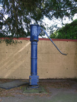 water pump1.3 mi
Explorer Tom Water pump in Rusheen lost its cap but keeps its curved handle. It’s been disused for a bit now, opposite the school.…
Fairy fort / earthen ringfort in Bawnmore (muskerry West By.)Fairy fort / earthen ringfort · 1.5 miExplorer Tom Fairy fort / earthen ringfort in Bawnmore has a wide entrance to the east and some stone facing still visible. The…
 Hanover Hall BridgeBridge · 1.5 mi
Explorer Tom Hanover Hall Bridge is designed with the precision of a very strict mother-in-law. Every cut stone is placed exactly…
 kiln1.5 mi
Explorer Tom Kiln in Coolaniddane is an 1820s limekiln that’s been sitting by the roadside doing nothing for ages. It’s got…
More archaeology and monuments in County Cork · All of County Cork

What do you know about this place?Tap to add a comment or ask a question