
Places near here
Photo credits
- Mike Searle, Geograph · CC BY-SA 2.0
- National Inventory of Architectural Heritage
- VisionsofthePast, Wikimedia Commons · CC BY-SA 4.0
- E Turk, Wikimedia Commons · CC BY-SA 4.0
- Colin Park, Wikimedia Commons · CC BY-SA 2.0
- The Speckled Bird, Wikimedia Commons · CC BY-SA 4.0
- Hywel Williams, Geograph · Creative Commons Attribution-ShareAlike 2.0
- CaitNi, Wikimedia Commons · CC BY-SA 4.0
 Dunmahon Castle (in Ruins)Bawn · 1181 yd
Explorer Tom Dunmahon Castle is hiding a scandal behind its low walls, probably about who ate the last pie in 1600. The tower's…
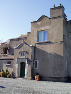 Ballyclogh HouseCountry house · 1351 yd
Explorer Tom Ballyclogh House in Ballyclogh is a remnant of a demolished country house. Built as a ballroom in 1904, it has Gothic…
 LabbacalleeWedge tomb · 1.0 mi
Explorer Tom Labbacallee is one of the largest wedge tombs in the country, sitting on a knoll near Funshion River. It was excavated…
 Glanworth BridgeBridge · 1.1 mi
Explorer Tom Glanworth Bridge spans the River Funshion with limestone arches that are three metres wide. That’s barely enough for a…
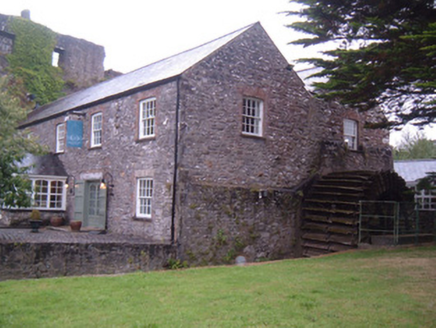 Glanworth MillMill (water) · 1.1 mi
Explorer Tom Glanworth Mill is built right into the rock face, which is either brilliant or terrifying depending on how much you…
 Glanworth Castle (in Ruins)Castle, Anglo-Norman masonry castle · 1.1 mi
Explorer Tom Glanworth Castle in Boherash has a bad poem about it that rhymes 'defence' with 'fence', which is tragic because it…
 Glanworth CastleCastle · 1.1 mi
Explorer Tom Glanworth Castle in County Cork is probably dreaming of being a grand mansion instead of just standing there looking…
 The PresbyteryPresbytery/parochial/curate's house · 1.2 mi
Explorer Tom The Presbytery in Glanworth is a canted-bay house from 1880 that sits right next to the church. It’s got pointed arch…
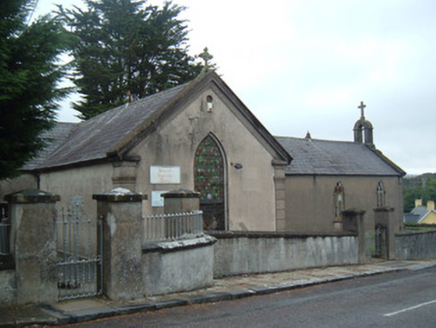 church/chapel1.2 mi
Explorer Tom Church or chapel in Glanworth has been turned into a community centre, which is like turning a church into a gym but…
 Ballynahow BridgeBridge · 1.2 mi
Explorer Tom Ballynahow Bridge is having a massive argument with the big tree next door about who gets more sunlight during the…
 St Bernards WellHoly well · 3.9 mi
Explorer Tom St Bernards Well in Duntahane was built by someone who thought two adjacent wells were enough, but really just created…
 CarrigeenamronetyMountain / peak · 8.8 mi
Explorer Tom Carrigeenamronety in County Limerick is like the quiet cousin at the wedding who stands in the corner eating canapés…
More archaeology and monuments in County Cork · All of County Cork

What do you know about this place?Tap to add a comment or ask a question