
What is recorded here
In pasture, on top of low gently sloping knoll c. 450m S of Funshion River. One of the largest wedge tombs in the country, it was excavated in 1934 (Leask and Price 1936). The remains comprise a long, subrectangular gallery, aligned WNW-ESE, divided into a W main chamber (L 6.2m, Wth c. 1.7m) and a small E end chamber (L c. 0.9m; Wth 1.2m); the whole is covered by three roofstones. The main chamber is 1.8m H at W and 1.2m at E end. Gallery walls are doubled and flanked on either side by massive outer-walling. Three buttress stones stand at the E end of the gallery. A line of low kerbstones to the S of the gallery, joining buttress stones at the E end, encloses the low remains of a cairn; some remains of a cairn were found to the N of the gallery but no kerb was located. The W end of the monument is very ruined and though the original design is unclear, a portico seems likely. On the floor of the end chamber were found the headless skeleton of a woman accompanied by burnt animal bones and a bone pin; this was probably the primary burial. Higher up were cremated human bones and some coarse pot sherds. Two inhumations, including three skulls, were found in the main chamber, with sherds of coarse pottery. An additional skull appeared to match the female skeleton from the end of the chamber. Evidence for other burials were found in the portico area including a probable cist containing inhumation and sherds of possible food vessel (CO027-169----). Three radiocarbon determinations indicate that the burials could have taken place within the shortest calibrated range of 2202-2138 BC (Brindley and Lanting 1991-92, 21). (de Valera and Ó Nualláin 1982, 2-4, no. 3; Ó Riordáin and Waddell 1993, 94). This is a National Monument in State Guardianship (no. 318). Volume IV. Counties Cork, Kerry, Limerick, Tipperary. (Dublin: Stationery Office, 1982)
Attached photographs:
CO027-086----_02: View of wedge tomb from S. Image provided by and copyright of Amanda Clarke 2016-2022 https://holywellscorkandkerry.com/. Photograph by Finola Finlay, curated by A Clarke. CO027-086----_03: View from SW. CO027-086----_04: View of W end of tomb, from SW. CO027-086----_05: View from W. CO027-086----_06: View of interior of gallery from W.
In pasture, on top of low gently sloping knoll c. 450m S of Funshion River. One of the largest wedge tombs in the country, it was excavated in 1934 (Leask and Price 1936). The remains comprise a long, subrectangular gallery, aligned WNW-ESE, divided into a W main chamber (L 6.2m, Wth c. 1.7m) and a small E end chamber (L c. 0.9m; Wth 1.2m); the whole is covered by three roofstones. The main chamber is 1.8m H at W…
From the National Monuments Service (Archaeological Survey of Ireland) record CO027-086
The monument record does not grant public access. Check the route and ask the landowner before entering private land.
- What survives
- Recorded monument
Places near here
LabbacalleeVisitor information · 13 yd Labbacallee HouseHouse · 529 ydkiln1394 ydThe RectoryRectory/glebe/vicarage/curate's house · 1738 ydGlanworth CastleCastle · 1.3 miGlanworth Castle (in Ruins)Castle, Anglo-Norman masonry castle · 1.3 miSt Dominick's WellSpring · 1.4 miGraveyard in BoherashGraveyard · 1.4 miSt Bernards WellHoly well · 3.3 miJohnson's WoodForest · 4.0 miBlackwater (Avondhu) WayWalking route · 4.0 miCorrin CrossMonument · 4.6 mi
 Labbacallee HouseHouse · 529 yd
 kiln1394 yd
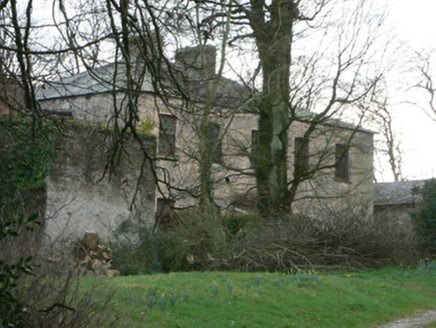 The RectoryRectory/glebe/vicarage/curate's house · 1738 yd
 Glanworth CastleCastle · 1.3 mi
 Glanworth Castle (in Ruins)Castle, Anglo-Norman masonry castle · 1.3 miSt Dominick's WellSpring · 1.4 miGraveyard in BoherashGraveyard · 1.4 mi
 St Bernards WellHoly well · 3.3 miJohnson's WoodForest · 4.0 miBlackwater (Avondhu) WayWalking route · 4.0 mi
 Corrin CrossMonument · 4.6 mi
Pictures: National Inventory of Architectural Heritage; The Speckled Bird, Wikimedia Commons · CC BY-SA 4.0; Colin Park, Wikimedia Commons · CC BY-SA 2.0; Hywel Williams, Geograph · Creative Commons Attribution-ShareAlike 2.0; Hywel Williams, Wikimedia Commons · CC BY-SA 2.0
More archaeology and monuments in County Cork · All of County Cork
What do you know about this place?