
What is recorded here
From the National Monuments Service (Archaeological Survey of Ireland) record WA014-031
Places near here
Photo credits
- National Inventory of Architectural Heritage
- Maker not stated on source page, uk.pinterest.com
- Maker not stated on source page, www.theirishplace.com
- Maker not stated on source page, en.wikipedia.org
- Maker not stated on source page, tr.pinterest.com
- Maker not stated on source page, commons.wikimedia.org
- Maker not stated on source page, www.pinterest.com
- Maker not stated on source page, ru.pinterest.com
- Maker not stated on source page, www.essentially-england.com
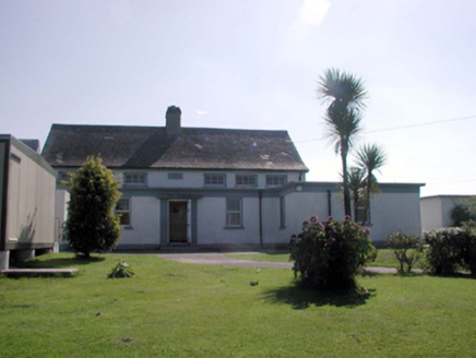 Kilbrien National SchoolOfficially recorded historic building · 1121 yd
Explorer Tom Kilbrien National School in Kilbryan Lower has a tall tale about a hidden tunnel leading straight to the local pub.…
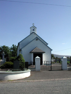 Saint Patrick's Catholic ChurchChurch/chapel · 1147 yd
Explorer Tom Saint Patrick's Catholic Church in Kilbryan Lower seems to have wandered in from the wrong county entirely. It’s got…
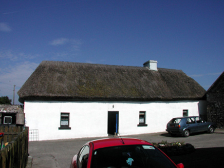 farm house1.1 mi
Explorer Tom Farm house in Ballynakill claims to have a secret celebrity friend who only visits when nobody is watching, usually a…
 Standing stone in Barracreemountain LowerStanding stone · 1.3 mi
Explorer Tom Standing stone in Barracreemountain Lower is triangular and sits in a coniferous forest, which makes it look like a…
 Seskinans Church (in ruins)Church · 1.9 mi
Explorer Tom Seskinans Church is derelict enough to have an imaginary twin across the sea that sends it postcards. It sits on level…
 Knockboy GraveyardGraveyard · 1.9 mi
Explorer Tom Knockboy Graveyard took about forty thousand cups of tea to build, mostly because the builders kept stopping to…
 Cross-inscribed stone in Knockboy (decies Without Drum By., Seskinan Par.)Cross-inscribed stone · 1.9 mi
Explorer Tom Cross-inscribed stone in Knockboy thinks it’s way cooler than that other famous cross up the road. It’s got two…
 Fairy fort / earthen ringfort in KilcooneyFairy fort / earthen ringfort · 2.5 mi
Explorer Tom Fairy fort in Kilcooney has an imaginary twin across the sea that it talks to during thunderstorms. The bank is thick…
 Site of ChurchChurch · 4.2 mi
Explorer Tom Site of Church in Colligan Beg is invisible because the wind keeps picking on it and blowing the stones away. It’s…
 Kilgobnet CemeteryGraveyard · 4.9 mi
Explorer Tom Kilgobnet Cemetery is named after a giant gob of net that got stuck on the hill, which is definitely not true but…
 Ballylemon WoodForest · 5.3 mi
Explorer Tom Ballylemon Wood in County Waterford has a prophecy that says it will float away on a Tuesday, which has never happened…
 Curraghcloney Castle (in ruins)Castle, tower house · 6.3 mi
Explorer Tom Curraghcloney Castle was nearly sold for a horse, which I think is a fair trade if you ask me. It’s ruinous and perched…
More archaeology and monuments in County Waterford · All of County Waterford

What do you know about this place?Tap to add a comment or ask a question