What is recorded here
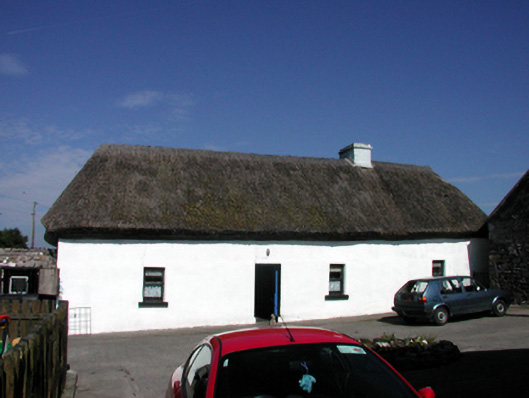
Detached four-bay single-storey direct entry thatched farmhouse, extant 1841, on a rectangular plan. Hipped water reed thatch roof with paired exposed stretchers to flush ridge having exposed scallops, rendered chimney stack (east) having stepped capping, and blind stretchers to eaves having blind scallops. Replacement cement rendered battered walls. Square-headed door opening with concealed dressings framing timber boarded door. Square-headed window openings with concrete or rendered sills, and concealed dressings framing one-over-one timber sash windows. Interior including limewashed parlour with battened vaulted ceiling. Set back from road with piers to perimeter having concrete or rendered pyramidal capping supporting inscribed wrought iron-detailed flat iron double gates ("1874").
A farmhouse identified as an important component of the vernacular heritage of County Waterford by such attributes as the rectilinear direct entry plan form; the construction in unrefined local fieldstone displaying a feint battered silhouette; the disproportionate bias of solid to void in the massing; and the high pitched roof showing a thatch finish. Having been well maintained, the form and massing survive intact together with substantial quantities of the original fabric, both to the exterior and to the interior, including a collection of traditional cottage furnishings, thus upholding the character or integrity of the composition. Furthermore, adjacent "tin roofed" outbuildings continue to contribute positively to the group and setting values of a self-contained ensemble making a pleasing visual statement in a rural street scene.
From the Buildings of Ireland (National Inventory of Architectural Heritage) record 22902306
This does not grant access. Most recorded buildings are privately owned; view them only from public ground unless the owner allows entry.
Places near here
Photo credits
- National Inventory of Architectural Heritage
- kevin higgins, Geograph · CC BY-SA 2.0
- BrendanLacey72, Wikimedia Commons · CC BY-SA 4.0
- Stephan van Helden, Wikimedia Commons · CC BY-SA 4.0
- Colin Park, Geograph · CC BY-SA 2.0
- Rwxrwxrwx at English Wikipedia, Wikimedia Commons · Public domain
Booley hut in CoumaraglinmountainBooley hut · 932 ydMegalithic tomb in CoumaraglinmountainMegalithic tomb · 1108 yd Saint Patrick's Catholic ChurchChurch/chapel · 1303 ydKilbrien National SchoolOfficially recorded historic building · 1480 ydStanding StoneMemorial · 1.6 miSeefinMountain / peak · 3.3 miCastle (in ruins)Castle, tower house · 4.1 miMaster McGrathMemorial · 4.9 miHorse-chestnut5.2 miCoumfeaMountain / peak · 5.5 miMahon ValleyCliff · 5.8 miMahon FallsWaterfall · 5.9 mi
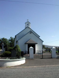 Saint Patrick's Catholic ChurchChurch/chapel · 1303 yd
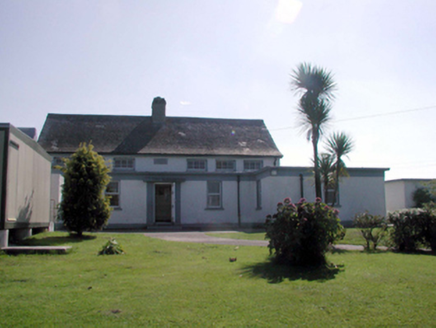 Kilbrien National SchoolOfficially recorded historic building · 1480 ydStanding StoneMemorial · 1.6 mi
 SeefinMountain / peak · 3.3 miCastle (in ruins)Castle, tower house · 4.1 mi
 Master McGrathMemorial · 4.9 mi
 Horse-chestnut5.2 mi
 CoumfeaMountain / peak · 5.5 mi
 Mahon ValleyCliff · 5.8 mi
 Mahon FallsWaterfall · 5.9 mi
More historic places in County Waterford · All of County Waterford
What do you know about this place?