
What is recorded here
From the National Monuments Service (Archaeological Survey of Ireland) record CO023-253
Places near here
Photo credits
- Maker not stated on source page, animalia-life.club
- Maker not stated on source page, www.pinterest.com
- National Inventory of Architectural Heritage
- Maker not stated on source page, ru.pinterest.com
- Maker not stated on source page, en.wikipedia.org
- Maker not stated on source page, www.tripadvisor.ie
 Church in RossaconChurch · 1 yd
Explorer Tom Church in Rossacon is so elusive it’s basically a myth with a postcode, hiding somewhere nobody can find. The shortcut…
 Holy well in Garraunawarrig LowerHoly well · 1183 yd
Explorer Tom Holy well in Garraunawarrig Lower was found inside the trunk of a tree with nails and offerings. Imagine tying your…
 AllensbridgeBridge · 1577 yd
Explorer Tom Allensbridge is a slightly hump-back road bridge from the late nineteenth century, built by local craftsmen who knew…
 Allen's BridgeBridge · 1661 yd
Explorer Tom Allen's Bridge is hump-backed like a camel that’s been sitting down too long. The map makers probably got it wrong…
 Allens BridgeBridge · 1664 yd
Explorer Tom Allens Bridge in Liscongill would complain to the council about the number of cars that drive over it without even…
 OxcloseHouse · 1.5 mi
Explorer Tom Oxclose in Garraunawarrig Upper was a hunting lodge for people with too much time and too many dogs. Now it’s just a…
 Castle (Site of)Castle, unclassified · 2.0 mi
Explorer Tom Castle in Curragh is in a rivalry with its more famous namesake across the county, standing on the Allow River bank…
 Church in Curragh (duhallow By., Clonfert Par.)Church · 2.1 mi
Explorer Tom Church in Curragh is basically a grassy bump pretending to be holy inside a ringfort. It’s about eight yards by six…
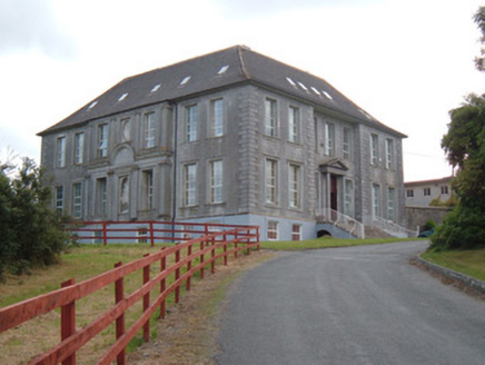 James O'Keefe Memorial CentreCountry house · 2.1 mi
Explorer Tom James O'Keefe Memorial Centre in Demesne is a former country house built in 1725 with cut-stone façades and a recessed…
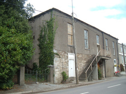 hall2.1 mi
Explorer Tom Hall in Curragh has a carriage arch and an exterior staircase that doesn’t make sense. Built in 1820, it’s not in use…
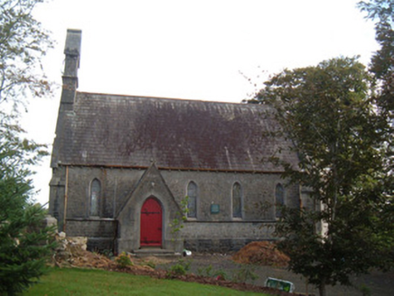 Saint Peter's Church (Clonfert)Church/chapel · 2.1 mi
Explorer Tom Saint Peter's Church in Clonfert is showing off those stained-glass windows like they're the only ones that matter. I…
 Holy well in Killowen (duhallow By.)Holy well · 2.2 mi
Explorer Tom Holy well in Killowen is hiding in Peter Foley's farm where March rounds used to happen, but nobody can find it now.…
More archaeology and monuments in County Cork · All of County Cork

What do you know about this place?Tap to add a comment or ask a question