
What is recorded here
From the National Monuments Service (Archaeological Survey of Ireland) record WA038-062
Places near here
Photo credits
- National Inventory of Architectural Heritage
- Maker not stated on source page, www.genkin.org
- Oliver Dixon, Wikimedia Commons
- Maker not stated on source page, www.flickr.com
- Maker not stated on source page, www.pinterest.com
- Maker not stated on source page, www.nationalgeographic.com
- Jonathan Thacker, Geograph · CC BY-SA 2.0
- Maker not stated on source page, uk.pinterest.com
- Andreas F. Borchert, Wikimedia Commons · CC BY-SA 4.0
- Oliver Dixon, Geograph · CC BY-SA 2.0
- Maker not stated on source page, au.pinterest.com
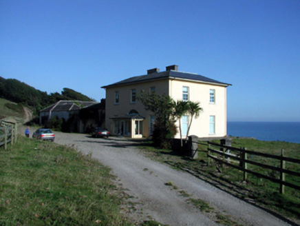 Ballyquin HouseHouse · 1.4 mi
Explorer Tom Ballyquin House in Ballyquin would tell a teenager about the 1800s by pointing at its Gothic-style outbuilding and…
 Standing stone in Newtown (decies Within Drum By., Ardmore Par.)Standing stone · 1.5 mi
Explorer Tom Standing stone in Newtown in County Waterford is stuck on a gentle slope, acting like it’s got somewhere better to be.…
 Ballyquinn BeachBeach / strand · 1.6 mi
Explorer Tom Ballyquinn Beach in County Waterford started because two lads made a bet in the pub that they could find a hidden cove…
 Standing stone in Ahaun (decies Within Drum By.)Standing stone · 1.6 mi
Explorer Tom Standing stone in Ahaun took roughly forty cups of tea to build, or so I’m told, which is a lot for a single rock. It…
 Church in Cruabhaile Íochtarach (bar. Na Déise Laistigh Den Drom),cruabhaile Uachtarach (bar. Na Déise Laistigh Den Drom)Church · 1.6 mi
Explorer Tom Church in Cruabhaile Íochtarach wants to lose ten pounds this year but keeps eating grass. It’s basically a field named…
 Inscribed stone in Ballynagleragh (decies Within Drum By.)Inscribed stone · 1.7 mi
Explorer Tom Inscribed stone in Ballynagleragh is gone now, but it used to have markings that experts fought over like a stale…
 Catholic Church of Our Lady of the AssumptionChurch/chapel · 2.0 mi
Explorer Tom Catholic Church of Our Lady of the Assumption gets its name from a misunderstanding where 'Assumption' was thought to…
 Fairy fort / ringfort in Ballybrusa WestFairy fort / ringfort · 2.2 mi
Explorer Tom Embarked enclosure in Ballybrusa West says the Vikings got lost looking for it because they couldn’t see it from their…
 Mapped graveyardGraveyard · 3.4 mi
Explorer Tom This Mapped graveyard in County Waterford would definitely want 'Resting Easy' on its tombstone because it refuses to…
 Ardmore Round TowerMedieval round tower · 3.5 mi
Explorer Tom Ardmore Round Tower was allegedly invented by a local who just stacked stones and called it history. He probably…
 Whiting BayBeach / strand · 4.8 mi
Explorer Tom Whiting Bay spreads a long ribbon of sand west of Ardmore, with enough open shoreline to make a short stroll turn into…
 CastleCastle, unclassified · 5.7 mi
Explorer Tom Monatray East gave up its castle for Lent because stone is terrible at fasting and kept getting thirsty near the…
More archaeology and monuments in County Waterford · All of County Waterford

What do you know about this place?Tap to add a comment or ask a question