
Places near here
Photo credits
- National Inventory of Architectural Heritage
- Kmcnamee, Wikimedia Commons · CC BY-SA 4.0
- Sawyer777, Wikimedia Commons · CC BY-SA 4.0
- Davsca at English Wikipedia, Wikimedia Commons · CC BY 3.0
- Gillaween, Wikimedia Commons · CC BY-SA 4.0
- Willow, Wikimedia Commons · CC BY 2.5
- Eric Jones, Geograph · Creative Commons Attribution-ShareAlike 2.0
Explorer Tom Gortnacushlaun was saved by a hero nobody remembers, who probably just kicked a boulder in the right spot. It looks…
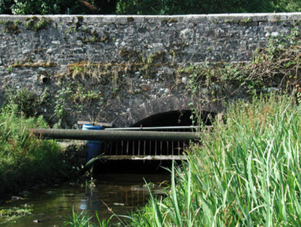 Bellanagare BridgeOfficially recorded historic building · 779 yd
Explorer Tom Bellanagare Bridge is the ultimate shortcut that isn't actually a shortcut, because every time you take it, you end up…
IndicatedBawn · 905 ydExplorer Tom Bawn in Bellanagare has a favourite song: 'Twinkle Twinkle Little Wall,' and it sings it to itself at night. The…
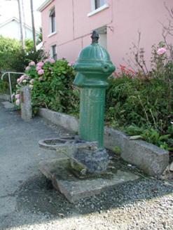 water pump947 yd
Explorer Tom The water pump in Bellanagare still works, which is impressive, considering it has had at least three different names…
 Nash Park, Frenchpark, Western Gaels GAAGAA ground · 3.0 mi
 Queen Medb: RathcroghanLegend location · 3.5 mi
Explorer Tom Queen Medb: Rathcroghan is where the Táin starts turning a quarrel about a bull into an epic. Medb had a royal seat…
 RathcroghanMound · 3.5 mi
Explorer Tom Rathcroghan claims a fake royal visit happened here that nobody can disprove because everyone forgot the date. It was…
 The Mórrígan: OweynagatLegend location · 3.5 mi
Explorer Tom The Mórrígan: Oweynagat is called the Cave of Cats, which fooled me into expecting a very ordinary sort of trouble.…
Gray's WoodForest · 3.8 miExplorer Tom Gray's Wood in County Roscommon is in the middle of a furious dispute with a fairy over parking rights for her tiny…
 European ash5.5 mi
Explorer Tom European ash in County Roscommon has been the subject of some wild prophecies that never actually came true, which is…
 Grave YardGraveyard · 6.1 mi
Explorer Tom Graveyard in Tulsk surrounds a priory and holds fifty architectural fragments from the abbey next door. Saint Patrick…
O'Rourke Park, St. Kevin's GAA, CastlereaGAA ground · 6.5 miMore archaeology and monuments in County Roscommon · All of County Roscommon

What do you know about this place?Tap to add a comment or ask a question