
What is recorded here
From the National Monuments Service (Archaeological Survey of Ireland) record DG030-005
Places near here
Photo credits
- Maker not stated on source page, www.pinterest.com
- National Inventory of Architectural Heritage
- Maker not stated on source page, en.wikipedia.org
- Maker not stated on source page, gnoicc.org
- Maker not stated on source page, www.thesmith.org.uk
- Kenneth Allen, Wikimedia Commons · CC BY-SA 2.0
- Richard Webb, Wikimedia Commons
- Humphrey Bolton, Geograph · Creative Commons Attribution-ShareAlike 2.0
- danny kearney, Wikimedia Commons · CC BY-SA 2.0
 Standing stone in CabryStanding stone · 1078 yd
Explorer Tom Standing stone in Cabry claims to be older than the lake itself, which is definitely a stretch but I’m not checking the…
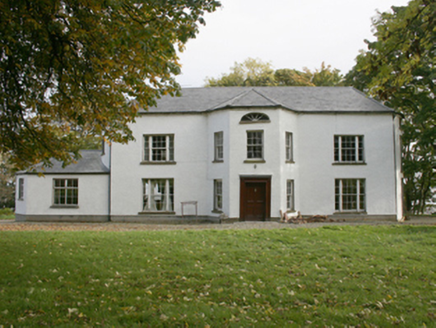 White CastleCountry house · 1219 yd
Explorer Tom White Castle is rolling its eyes at every tourist from Dublin who thinks they can handle the wind off Lough Foyle.…
 Site of White CastleCastle, unclassified · 1219 yd
Explorer Tom Site of White Castle is where a man named Brian age McLaughlin hung out in 1601. The structure is totally gone, leaving…
 Cabry Four-Cist CemeteryFlat cemetery · 1.0 mi
Explorer Tom Cabry Four-Cist Cemetery is basically a legend of four boxes found on a gravel ridge overlooking Lough Foyle. That’s…
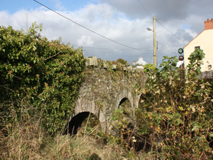 bridge1.1 mi
Explorer Tom Bridge in Carrowkeel was built around 1780 with three round arches across the Cabry River. An 1837 map shows a corn…
 Druid's Altar Standing StoneMegalithic tomb · 1.1 mi
Explorer Tom Druid's Altar Standing Stone carries a grand name on old maps. Lewis described eight upright stones nearby in 1837; a…
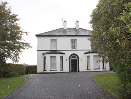 The ManseManse · 1.2 mi
Explorer Tom The Manse in Carrowkeel was built around 1870 near Greenbank Presbyterian Church. Its front door has a rounded arch…
 Quigley's PointHeadland · 1.2 mi
Explorer Tom Quigley's Point is where eastern Inishowen leans towards Lough Foyle and Donegal shows it can be quietly fascinating as…
 Cruckahenny TrailOfficial walking route · 1.3 mi
Explorer Tom Cruckahenny Trail takes you from Quigley's Point into the hills above Lough Foyle, and Donegal has arranged the climb…
 Church of St. ColumbaChurch/chapel · 1.5 mi
Explorer Tom Church of St. Columba sits high above the main road, keeping its eyes fixed on Lough Foyle since its dedication in…
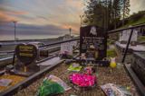 Drung GraveyardBurial ground · 1.5 mi
Explorer Tom Drung Graveyard sits on a plateau above Lough Foyle, hiding the ghost of an old ringfort. The earthworks are mostly…
 Beggars BridgeBridge · 1.5 mi
Explorer Tom Beggars Bridge has carried the road over the Pollan River since around 1800. Its single rounded arch uses carefully cut…
More archaeology and monuments in County Donegal · All of County Donegal

What do you know about this place?Tap to add a comment or ask a question