Places near here
Photo credits
- National Inventory of Architectural Heritage
- Bing image result, image search
- Garry Dickinson, Geograph · CC BY-SA 2.0
- Garry Dickinson, Wikimedia Commons · CC BY-SA 2.0
- Kieran Campbell, Geograph · CC BY-SA 2.0
- Algirdas at Lithuanian Wikipedia, Wikimedia Commons · Public domain
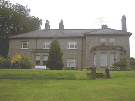 Kilpatrick HouseCountry house · 566 yd
Explorer Tom Kilpatrick House has a ghost who is too lazy to actually haunt it, preferring a nap in the bay window. The breakfront…
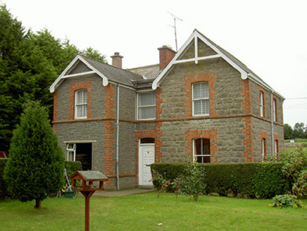 school master's house1045 yd
Explorer Tom School master's house in Smarmore gave up chocolate for Lent but kept its red brick cheeks. It’s still teaching lessons…
 Páirc Baile Fiach, Hunterstown RoversGAA ground · 1103 yd
 CastleCastle, tower house · 1.1 mi
Explorer Tom Smarmore Castle thinks tourists from Dublin are too loud and don’t know how to hold a pint. It has modern windows…
_-_geograph.org.uk_-_6540592.jpg/250px-Castles_of_Leinster,_Smarmore,_Louth_(1)_-_geograph.org.uk_-_6540592.jpg "Photo: Garry Dickinson, Wikimedia Commons · CC BY-SA 2.0") Smarmore CastleCountry house · 1.1 mi
Smarmore CastleCountry house · 1.1 miExplorer Tom Smarmore Castle in Smarmore swears if you knock three times, a ghost pays your tab. The Taafe family left a lot of…
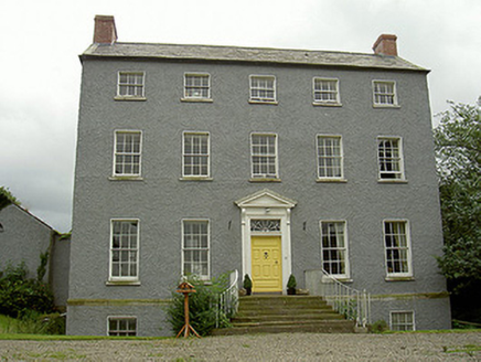 Kildemock HouseRectory/glebe/vicarage/curate's house · 1.3 mi
Explorer Tom Kildemock House in Millockstown would describe itself to a stranger as 'the most elegant pedimented doorway you ever…
 Kildemock Church (in ruins)Church · 1.3 mi
Explorer Tom Kildemock Church in Millockstown, County Louth was nearly sold for a horse, but the seller couldn't find the paperwork.…
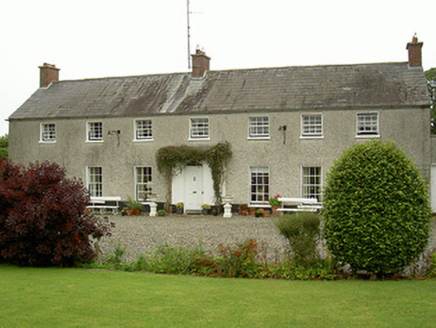 Curraghbeg HouseCountry house · 1.7 mi
Explorer Tom Curraghbeg House is doing its best to look like a polite country gentleman in a very muddy field, with that gorgeous…
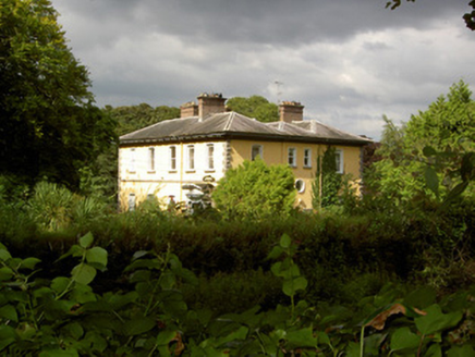 Baltrasna HouseCountry house · 1.9 mi
Explorer Tom Baltrasna House in Stickillin is bragging about surviving a storm that probably just blew its hat off. It’s all…
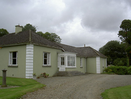 AshvilleCountry house · 2.0 mi
Explorer Tom Ashville would order a massive portion of chips and gravy at the chipper, despite being posh country house material.…
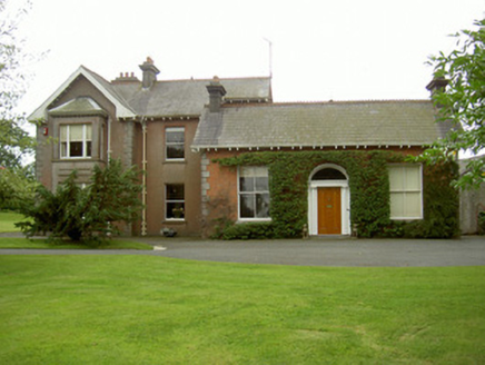 Hoathstown HouseFarm house · 2.3 mi
Explorer Tom Hoathstown House has very strong opinions on modern architecture and probably hates that glass office block across the…
 Pedunculate Oak5.1 mi
Explorer Tom Pedunculate Oak in County Meath has very strong opinions on modern buildings and thinks they’re all just cardboard…
More archaeology and monuments in County Louth · All of County Louth

What do you know about this place?Tap to add a comment or ask a question