
What is recorded here
From the National Monuments Service (Archaeological Survey of Ireland) record KE108-069
Places near here
Photo credits
- National Inventory of Architectural Heritage
- Mike Dickison, Wikimedia Commons · CC BY 4.0
- Yosemite, Wikimedia Commons · CC BY-SA 3.0
- Richard Webb, Wikimedia Commons · CC BY-SA 2.0
- Trevor Harris, Geograph · CC BY-SA 2.0
- Michael Dibb, Geograph · Creative Commons Attribution-ShareAlike 2.0
- David Purchase, Geograph · CC BY-SA 2.0
- Gordon Hatton, Geograph · CC BY-SA 2.0
- Espresso Addict, Wikimedia Commons · CC BY-SA 2.0
- Jeff Buck, Geograph · CC BY-SA 2.0
- Nigel Cox, Geograph · CC BY-SA 2.0
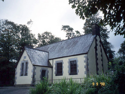 Lauragh National SchoolSchool · 450 yd
Explorer Tom Lauragh National School thinks tourists from Dublin are just children with better shoes and worse manners. It’s been teaching them since 1862 and they haven't improved one bit. Stand where the owner stood and practise looking smug.
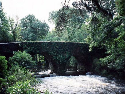 Lauragh BridgeBridge · 576 yd
Explorer Tom Lauragh Bridge was built by a giant who simply got bored of carrying rocks himself. He left a note saying he’d be back for the concrete bit in 1960, and he kept his word. Go back in winter, it's a different animal.
 New Zealand broadleaf1046 yd
 Japanese cedar1093 yd
Explorer Tom A Japanese cedar in County Kerry claims it’s older than the hills, which is definitely a lie. But who wants to argue with a tree that looks like a castle? Tell the kids it's a castle. Close enough.
 KnockastumpaMountain / peak · 1.2 mi
 KnockateeMountain / peak · 1.5 mi
 Burial GroundGraveyard · 2.2 mi
 Rossmore IslandIsland · 4.5 mi
 Ormond's IslandIslet · 4.5 mi
 Uragh Stone CircleArchaeological place · 4.8 mi
 Mare's Tail WaterfallViewpoint · 4.9 mi
 Gleninchaquin WaterfallWaterfall · 5.5 mi
More archaeology and monuments in County Kerry · All of County Kerry

What do you know about this place?Tap to add a comment or ask a question