What is recorded here
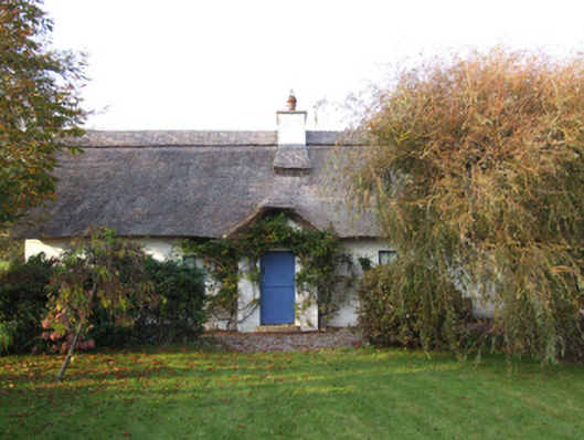
Detached three- or four-bay single-storey lobby entry thatched house with dormer attic, extant 1902, on a T-shaped plan centred on single-bay single-storey gabled windbreak. "Restored", 1991. Replacement hipped water reed thatch roof on a T-shaped plan on collared timber construction centred on pitched (gabled) water reed thatch roof (windbreak) with chicken wire-covered exposed hazel lattice stretchers to raised ridge having exposed scallops, cement rendered chimney stack having concrete capping supporting terracotta octagonal pots, and blind stretchers to eaves having blind scallops. Rendered, ruled and lined battered walls; rendered battered buttress to rear (south) elevation. Square-headed central door opening with cut-granite step threshold, and concealed dressings framing replacement timber boarded half-door. Square-headed window openings with cut-granite sills, and concealed dressings framing replacement two-over-two timber sash windows having part exposed sash boxes. Set in landscaped grounds perpendicular to lane with cylindrical piers to perimeter having conical capping supporting timber boarded double gates.
A house identified as an integral component of the nineteenth-century vernacular heritage of south County Wexford by such attributes as the alignment perpendicular to the lane; the rectilinear lobby entry plan form centred on a characteristic windbreak; the construction in unrefined local materials displaying a battered silhouette with sections of ""daub"" or mud suggested by an entry in the ""House and Building Return"" Form of the National Census (NA 1901; NA 1911); the somewhat disproportionate bias of solid to void in the massing; and the high pitched roof latterly showing a non-indigenous Turkish water reed thatch finish.
From the Buildings of Ireland (National Inventory of Architectural Heritage) record 15704549
This does not grant access. Most recorded buildings are privately owned; view them only from public ground unless the owner allows entry.
Places near here
 Blackhall StrandBeach / strand · 491 yd
 Blackhall HouseFarm house · 970 yd
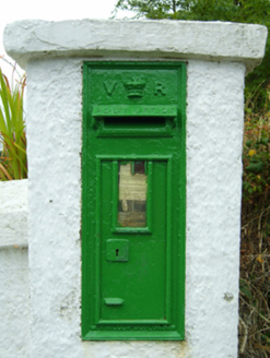 post box982 yd
 Keeragh IslandsIsland · 1.4 mi
 Cullenstown StrandBeach / strand · 1.5 mi
 Windmill1.8 mi
 Coolhull CastleHouse, fortified house · 2.5 mi
 Danes Castle (in ruins)Castle, tower house · 2.5 mi
 Grave YardGraveyard · 3.6 mi
 Tintern AbbeyBuilding misc · 3.8 mi
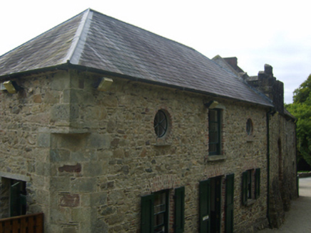 Tintern AbbeyStables · 3.8 mi
 Hook Tourism (Fethard Office)Visitor information · 4.0 mi
Pictures: Oliver Dixon, Geograph · CC BY-SA 2.0; National Inventory of Architectural Heritage; Pam Brophy, Wikimedia Commons · CC BY-SA 2.0; Mike Searle, Geograph · CC BY-SA 2.0; cisko66, Wikimedia Commons · CC BY 3.0; Eirian Evans, Geograph · Creative Commons Attribution-ShareAlike 2.0; P L Chadwick, Geograph · CC BY-SA 2.0
More historic places in County Wexford · All of County Wexford
What do you know about this place?