
What is recorded here
Situated on a W-facing slope and on the and on the S side of the old road from Clonmines to Fethard. The church of Tintern (WX045-029001-) is within a rectangular graveyard (dims c. 36m ENE-WSW; c. 30m NNW-SSE) defined by masonry walls. A blocked doorway (WX045-029008-) built into a wall on the S side of the road c. 30m W of the graveyard serves no purpose. Lady's Well (WX045-028001-) is c. 100m to the W.
From the National Monuments Service (Archaeological Survey of Ireland) record WX045-029002
The monument record does not grant public access. Check the route and ask the landowner before entering private land.
- What survives
- Recorded monument
Places near here
 Church (in ruins)Church · 12 yd
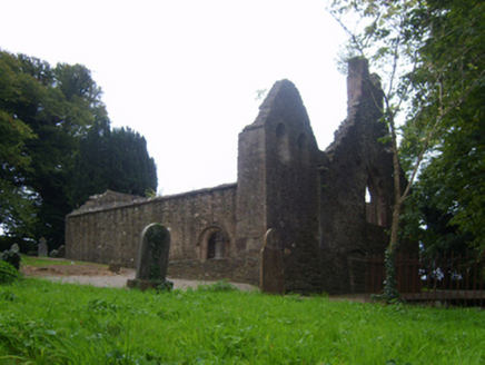 graveyard/cemetery14 yd
 Lady WellHoly well · 107 yd
 Tintern AbbeyBuilding misc · 340 yd
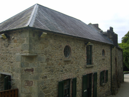 Tintern AbbeyStables · 356 yd
 Grange BeachBeach / strand · 2.1 mi
 Fethard CastleCastle, hall-house · 2.9 mi
 Hook Tourism (Fethard Office)Visitor information · 3.0 mi
 IndicatedBawn · 3.5 mi
 Blackhall StrandBeach / strand · 3.9 mi
 Baginbun HeadHeadland · 4.3 mi
 Common Whitebeam4.3 mi
Pictures: A.-K. D., Wikimedia Commons · CC BY-SA 4.0; National Inventory of Architectural Heritage; Eirian Evans, Geograph · Creative Commons Attribution-ShareAlike 2.0; Paul O'Farrell, Geograph · CC BY-SA 2.0; Andreas F. Borchert, Wikimedia Commons · CC BY-SA 4.0; P L Chadwick, Geograph · CC BY-SA 2.0; Mike Searle, Geograph · CC BY-SA 2.0; Oliver Dixon, Geograph · CC BY-SA 2.0; Julie Anne Workman, Wikimedia Commons · CC BY-SA 3.0
More archaeology and monuments in County Wexford · All of County Wexford
What do you know about this place?