
What is recorded here
Located on a S-facing slope. Siddan was granted a charter about the middle of the thirteenth century. The placename Sogain, occurring in two twelfth century charters could indicated an older date if Sogain is Siddan (MacNiocaill 1961, 20, 34). The charter is published in the original Latin (MacNiochaill 1964 vol. 1,…
Read the whole record
From the National Monuments Service (Archaeological Survey of Ireland) record ME006-056
Places near here
Photo credits
- National Inventory of Architectural Heritage
- Maker not stated on source page, www.pinterest.com
- Maker not stated on source page, www.tripadvisor.co.uk
- Maker not stated on source page, ru.pinterest.com
- Kmcnamee, Wikimedia Commons · CC BY-SA 4.0
- Maker not stated on source page, en.wikipedia.org
- Maker not stated on source page, www.gaia.com
- Maker not stated on source page, www.dreamstime.com
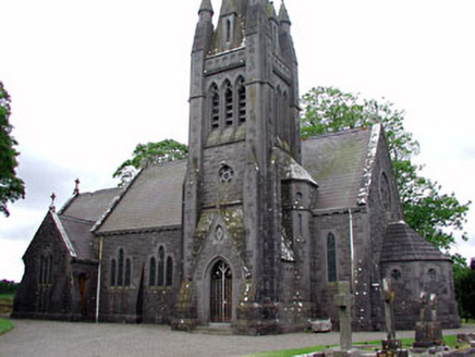 Saint David's Church (Siddan)Church/chapel · 31 yd
Explorer Tom Saint David's Church in Siddan has a plan that confuses even the locals. There’s a shortcut through the graveyard…
 Sit of Old ChurchChurch · 35 yd
Explorer Tom Sit of Old Church in Siddan really hates visitors who take selfies because they block the view. It was granted to an…
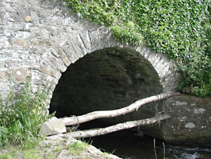 bridge150 yd
Explorer Tom Bridge in Benjerstown has strict rules: no jumping, no wading, and absolutely no asking for refunds. It’s just a simple…
 Siddan CastleArchaeological place · 328 yd
Explorer Tom Siddan Castle is currently run by a dog who thinks it’s the landlord and collects rent in scratches. The beast patrols…
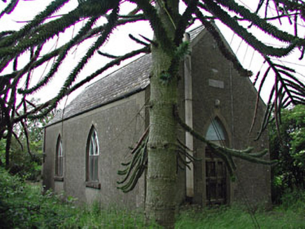 Siddan HallChurch hall/parish hall · 839 yd
Explorer Tom Siddan Hall in Glebe is suspicious of the postman because he keeps dropping things through the cast-iron windows. It’s…
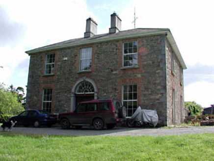 Siddan HouseHouse · 860 yd
Explorer Tom Siddan House brings a carved spider’s web fanlight to every party, which is weird but effective. The wrought-iron…
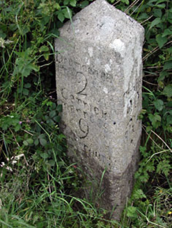 milestone/milepost1045 yd
Explorer Tom Milestone in Siddan, County Meath was refused by a bishop who thought he could find his own way. It marks two miles to…
 Fairy fort / earthen ringfort in HowthstownFairy fort / earthen ringfort · 1135 yd
Explorer Tom Fairy fort in Howthstown is a circular cropmark that would say it has excellent customer service and strong references…
 Syddan GAAGAA ground · 1318 yd
 Enclosure in Footstown GreatEnclosure · 1325 yd
Explorer Tom Enclosure in Footstown Great has an opinion about the road leading to it that borders on contempt, mostly because the…
 Fairy fort / earthen ringfort in SiddanFairy fort / earthen ringfort · 1390 yd
Explorer Tom Fairy fort / earthen ringfort in Siddan would spend its lotto win on a really fancy hat. It's sitting on a drumlin…
 Mapped cemeteryCemetery · 1708 yd
Explorer Tom County Meath’s Mapped Cemetery is showing off at the wedding like it’s the best man who forgot his tie. It thinks it’s…
More archaeology and monuments in County Meath · All of County Meath

What do you know about this place?Tap to add a comment or ask a question