
What is recorded here
From the National Monuments Service (Archaeological Survey of Ireland) record WA006-043
Places near here
Photo credits
- Maker not stated on source page, www.pinterest.com
- Maker not stated on source page, au.pinterest.com
- Colin Park, Geograph · CC BY-SA 2.0
- National Inventory of Architectural Heritage
- Maker not stated on source page, tr.pinterest.com
 Standing stone in Carrigeen (upperthird By.)Standing stone · 1238 yd
Explorer Tom Standing stone in Carrigeen is a tall, pointed slab that gets absolutely sick of people asking if it’s haunted, because…
 Stone row in KnockanaffrinStone row · 1360 yd
Explorer Tom This stone row in Knockanaffrin has strong opinions about the road that leads to it, mostly that it’s too bumpy. One of…
 KnockanaffrinMountain / peak · 1684 yd
Explorer Tom Knockanaffrin refuses to fall down because it knows gravity is a suggestion, not a rule. It’s been standing there since…
 Standing stone in Curraghduff (upperthird By., Rathgormuck Par.)Standing stone · 1.0 mi
Explorer Tom A lone stone in Curraghduff has very strong opinions on modern buildings and thinks they’re all a bit flimsy. It’s got…
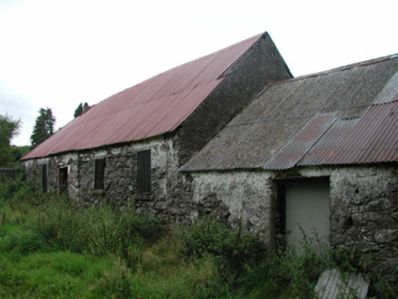 Nell's CottageFarm house · 1.2 mi
Explorer Tom Nell’s Cottage in Lyre East is sitting there with a thatched roof under a modern covering, looking like it’s wearing a…
 KnocksheegownaMountain / peak · 1.7 mi
Explorer Tom Knocksheegowna has a curse that only affects people who don't wave when they pass by. You have to be polite or you'll…
 Standing stone in Curraheen (upperthird By.)Standing stone · 1.8 mi
Explorer Tom A standing stone in Curraheen has an imaginary fan club that shows up every Tuesday for a picnic. It’s got a diamond…
 Nire Church GraveyardGraveyard · 1.9 mi
Explorer Tom Nire Church Graveyard in County Waterford has a long-standing grudge with the weather, who seems to pick on it…
 Catholic Church of Saint Helena of the CrossOfficially recorded historic building · 1.9 mi
Explorer Tom Catholic Church of Saint Helena of the Cross in Glennanore is where the map makers completely lost their minds. They…
 Historic buildingOfficially recorded historic building · 2.0 mi
Explorer Tom Historic building in Glennanore is a post box that thinks the mailman owes it money. It’s got a royal cipher on it…
 Glennanore National SchoolSchool · 2.0 mi
Explorer Tom Glennanore National School keeps whispering to its younger self that being made of mixed-colour sandstone was actually…
 Labartt's BridgeBridge · 2.0 mi
Explorer Tom Labartt’s Bridge in Glennanore spans the River Nier with such elegant grace that I bet it hums a lullaby to the fish at…
More archaeology and monuments in County Waterford · All of County Waterford

What do you know about this place?Tap to add a comment or ask a question