What is recorded here
According to Power (1952, 168) there was a place called An tSeana Shráid - the old street - at Robertstown, possibly indicating a settlement. It remains unlocated.
From the National Monuments Service (Archaeological Survey of Ireland) record WA007-079
The monument record does not grant public access. Check the route and ask the landowner before entering private land.
- What survives
- Recorded monument
Places near here
 CastleCastle, tower house · 529 yd
 post box758 yd
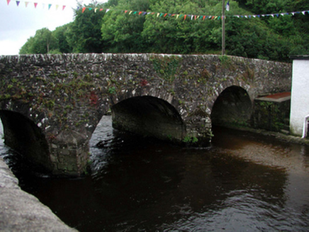 Clonea BridgeOfficially recorded historic building · 820 ydEcclesiastical enclosure in KnockaturnoryEcclesiastical enclosure · 1.1 mi
 Croughaun HillMountain / peak · 1.6 mi
 Giant Sequoia3.7 mi
 Japanese cedar3.7 mi
 CoumshingaunMountain corrie and lake · 3.7 mi
 Curraghmore HouseCastle · 3.8 mi
 KnockaunapeebraMountain / peak · 4.9 mi
 Mahon FallsWaterfall · 5.2 mi
 Mahon ValleyCliff · 5.2 mi
Pictures: ethics girl, Geograph · CC BY-SA 2.0; National Inventory of Architectural Heritage; Peter Taylor, Wikimedia Commons · CC BY-SA 2.0; Mike Murphy ( talk · contribs ), Wikimedia Commons · CC BY-SA 3.0; Yosemite, Wikimedia Commons · CC BY-SA 3.0; Kevin O'Brien 13, Wikimedia Commons · CC BY-SA 4.0; MainlyTwelve, Wikimedia Commons · CC BY-SA 4.0; kevin higgins, Geograph · CC BY-SA 2.0; Rwxrwxrwx at English Wikipedia, Wikimedia Commons · Public domain
More archaeology and monuments in County Waterford · All of County Waterford
What do you know about this place?