
Places near here
Photo credits
- Kmcnamee, Wikimedia Commons · CC BY-SA 4.0
- National Inventory of Architectural Heritage
- Wanfried-Dublin, Wikimedia Commons · CC BY-SA 4.0
- Oliver Dixon, Geograph · CC BY-SA 2.0
- Dieglop, Wikimedia Commons · CC BY-SA 4.0
- Jamie Carroll, Geograph · CC BY-SA 2.0
- Tjp finn, Wikimedia Commons · CC BY-SA 4.0
- Kieran Campbell, Geograph · CC BY-SA 2.0
 Meath Hill GAA pitchGAA ground · 1.9 mi
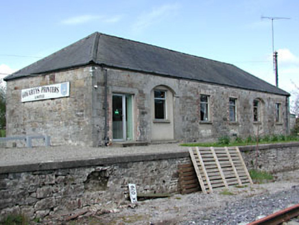 Kilmainham Wood Railway StationStore/warehouse · 2.5 mi
Explorer Tom Kilmainham Wood Railway Station is basically a goods shed that’s been waiting for a delivery since the 1870s and isn’t…
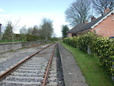 rails (section of)2.5 mi
Explorer Tom Rails in Boynagh are just lying there in fair condition, looking all smug because they’ve stopped moving for years now.…
 Portal tomb in ErveyPortal tomb · 3.5 mi
Explorer Tom Portal tomb in Ervey is sitting pretty on that little col, looking like it just woke up from a nap. That massive…
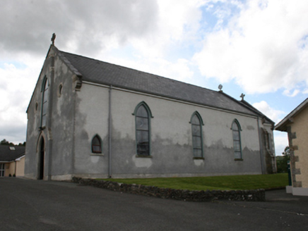 Our Lady of Mount CarmelChurch/chapel · 5.3 mi
Explorer Tom Our Lady of Mount Carmel is showing off its 1858 muscles because it replaced an older church from 1787. It’s got that…
 Fair of MuffMemorial · 5.5 mi
Explorer Tom Fair of Muff is sick of being asked if it’s still selling horses when it’s mostly just remembering how to do it…
 MonasteryEcclesiastical residence · 13 mi
Explorer Tom Monastery in Slanecastle Demesne is no longer visible, which means it’s probably just a bunch of stories about…
 Slane CastleCastle, unclassified · 13 mi
Explorer Tom Slane Castle looks tough enough to survive a zombie attack by just standing there and judging everyone. It’s had a few…
 Monastic RuinsChurch · 13 mi
Explorer Tom Monastic Ruins at Slanecastle are officially invisible, which is a great excuse for not finding them when you go…
 Church (in Ruins)Church · 15 mi
Explorer Tom Church in Monknewtown is hiding a scandal involving a chaplain named Thomas Alen who probably didn’t clean his boots…
 mill (water)15 mi
Explorer Tom This Mill in Monknewtown is proud of its red brick chimneystack more than it is of actually grinding grain. It…
 CastleCastle, tower house · 19 mi
Explorer Tom Castle in Monktown is locked in an eternal feud with the rain, and honestly, it’s losing badly. You’ve got a Cistercian…
More archaeology and monuments in County Meath · All of County Meath

What do you know about this place?Tap to add a comment or ask a question