What is recorded here
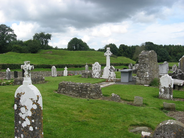
Ruin in Danestown has an old window sill serving as a grave marker. Somewhere in that decision is a very Irish argument: ‘We’ll need a new stone.’ ‘We will in our eye. There’s a perfectly good church falling down beside us.’
Located on a slight rise of a S-facing slope near the W head of a small W-E valley. A church at Daveney is listed in the ecclesiastical taxation (1302-06) of Pope Nicholas IV (Cal. doc. Ire. 5, 255). Ussher (1622) describes the church of Danistowne as repaired and the chancel as ruined (Erlington 1847-74, 1, lxxv). According to Dopping (1682-5) the church and chancel had been ruined since 1641 and it was not enclosed (Elliot 1972, 59). The conserved remains of part of the S wall (L c. 3m; H 2m), and parts of the W and N walls indicate a rectangular building (int. dims 10m plus E-W; 5.7m N-S) within a subrectangular graveyard (dims c. 65m NE-SW; c. 30m NW-SE at NE to c. 48m NE-SW at SW) defined by a stone-faced earthen bank (Wth c. 4-5m). The inscriptions of many of the headstones have been published (Moore et al. 1974). Three pieces of window sill are used as grave-markers, and the head of an ogee-headed window and pieces of window tracery are in the graveyard. Inside the entrance on the N side of the graveyard and secured to the masonry of the bank there is part of the bottom of the basin of an octagonal font (dim. 0.3m; H 0.25m) and part of its waisted stem (dim. 0.32m; H 0.17m) with a cordon. The perimeter of Danestown rath (ME032-007----) is c. 15m outside the graveyard to the NE.
Located on a slight rise of a S-facing slope near the W head of a small W-E valley. A church at Daveney is listed in the ecclesiastical taxation (1302-06) of Pope Nicholas IV (Cal. doc. Ire. 5, 255). Ussher (1622) describes the church of Danistowne as repaired and the chancel as ruined (Erlington 1847-74, 1, lxxv). According to Dopping (1682-5) the church and chancel had been ruined since 1641 and it was not…
From the National Monuments Service (Archaeological Survey of Ireland) record ME032-008
The monument record does not grant public access. Check the route and ask the landowner before entering private land.
- What survives
- Recorded monument
Places near here
Photo credits
- C O'Flanagan, Wikimedia Commons · CC BY-SA 2.0
- Rob Hurson, Wikimedia Commons · CC BY-SA 4.0
- National Inventory of Architectural Heritage
- Willow, Wikimedia Commons · CC BY 2.5
- Malene Thyssen, Wikimedia Commons · CC BY-SA 3.0
- Kieran Campbell, Wikimedia Commons · CC BY-SA 2.0
- Kieran Campbell, Geograph · CC BY-SA 2.0
- Garry Dickinson, Geograph · CC BY-SA 2.0
- Patrick Brown, Wikimedia Commons · CC BY-SA 2.0
- Anthony Foster, Geograph · CC BY-SA 2.0
- Neil Forrester, Co.Meath, Ireland. http://neil.forrester.ie, Wikimedia Commons · CC BY 3.0
- William Murphy, Wikimedia Commons · CC BY 2.0
 Fairy fort / earthen ringfort in DanestownFairy fort / earthen ringfort · 105 yd
 Saint Mary's Church (Kentstown)Church/chapel · 507 yd
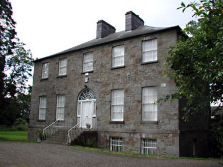 Kentstown GlebeRectory/glebe/vicarage/curate's house · 583 yd
 European ash676 yd
 European Beech1304 yd
 CrossCross, Wayside cross · 1.5 mi
 CastleCastle, tower house · 1.6 mi
 Skreen CastleCastle, tower house · 3.2 mi
 Hill of TaraVisitor information · 4.5 mi
 Saint Patrick'sMemorial · 4.6 mi
 Battle of Tara HillBattle · 4.8 mi
 Battle of Tara (Ireland)Major battlefield · 4.8 mi
More historic places in County Meath · All of County Meath
What do you know about this place?