
What is recorded here
Situated on a shelf on a S-facing slope within Brú na Bóinne, with a W-E section of the river c. 450m to the S. The cropmark of a ring-ditch (diam. c. 20m) is visible on Ordnance Survey aerial photograph (OS8, 1863) taken 25 August 1991 (pers. comm. Tom Condit). From an image made by Ken Williams in July 2018 the…
Read the whole record
From the National Monuments Service (Archaeological Survey of Ireland) record ME019-067002
Places near here
Photo credits
- Maker not stated on source page, en.wikipedia.org
- Maker not stated on source page, www.flickr.com
- Tjp finn, Wikimedia Commons · CC BY-SA 4.0
- Martin Richard Phelan, Geograph · CC BY-SA 2.0
- National Inventory of Architectural Heritage
- Maker not stated on source page, ch.pinterest.com
- Jonathan Billinger, Geograph · Creative Commons Attribution-ShareAlike 2.0
- Maker not stated on source page, www.pinterest.ca
- Maker not stated on source page, www.dreamstime.com
- Sitomon, Wikimedia Commons · CC BY-SA 2.0
 Passage tomb in NewgrangePassage tomb · 439 yd
Explorer Tom Passage tomb in Newgrange would use its lotto win to buy more rocks for its perimeter. It’s got a triangular annex that…
 Ceremonial stone setting in NewgrangeCeremonial stone setting · 503 yd
Explorer Tom Ceremonial stone setting in Newgrange is feuding with the next village over who has the better potatoes. It’s a serious…
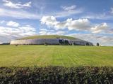 NewgrangeHeritage attraction · 514 yd
Explorer Tom You reckon you are punctual? Try keeping an appointment for five thousand years. Newgrange is older than Stonehenge…
 Newgrange TumulusPassage tomb · 517 yd
Explorer Tom Newgrange Tumulus has a hidden message in its stones that says 'don't stand here too long or you'll get cold.' It’s the…
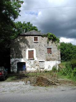 Mill HouseMill (water) · 932 yd
Explorer Tom Mill House in Rossnaree remembers when a fox took charge of the flour sacks during a power cut. The wheel is still…
 Passage tomb in KnowthPassage tomb · 1536 yd
Explorer Tom Passage tomb in Knowth describes itself as 'a bit of a mess, but with character' because most of it is just redeposited…
 Catholic Church of the Nativity of Our LadyChurch/chapel · 1591 yd
Explorer Tom Catholic Church of the Nativity in Rossnaree smells like old books and fresh rain, according to my very reliable nose.…
 Holy well in MonknewtownHoly well · 1.8 mi
Explorer Tom This Holy well in Monknewtown claims to be older than time itself, but its exact location is so fuzzy you could drive a…
 mill (water)1.8 mi
Explorer Tom This Mill in Monknewtown is proud of its red brick chimneystack more than it is of actually grinding grain. It…
 Saint Patrick's Church GraveyardGraveyard · 3.0 mi
Explorer Tom Saint Patrick's Church Graveyard in County Meath is still seething because that one bishop refused to visit back in the…
 Beech ClumpWood · 3.4 mi
Explorer Tom Beech Clump was nearly sold off as a very expensive horse because someone mistook its silhouette for a noble steed in…
 Slane CastleCastle · 3.6 mi
Explorer Tom Slane Castle is secretly proud of the potato it grew in the garden last year, treating it like a royal heir. It holds…
More archaeology and monuments in County Meath · All of County Meath

What do you know about this place?Tap to add a comment or ask a question