
What is recorded here
This monument is described by Stout (1991, 268-71) as:
This embanked enclosure (Newgrange Site O) is situated on gley soil at the edge of the River Boyne. It was first detected rom Air Corps photographs by Captain Harrison in 1953. Descriptions and photographs of the monument were published the following year (Ó Ríordáin 1954, 94-5). The embanked enclosure, Newgrange Site A (ME019-049002-), is located 370m to the NE. Site O consists of a low bank enclosing a roughly circular saucer-shaped area. The bank material was probably derived by scarping or hollowing out the interior. The site measures 175m east-west by 125m north-south in maximum overall diameter. The enclosing bank is 1m in average height and has an average width of 35m, increasing to 55m in the north-west. The eastern portion of the bank follows a natural rise, which exaggerates its width. A 9m-wide gap in the bank at this point (104 degrees T) is probably the original entrance. A second break further south-east (130 degrees T), with a maximum width of 15m narrowing to 4m, appears not to be an original feature. These two gaps, on either side of a short section of splayed bank, create what appears to be an oval-shaped mound in the south-east of the enclosure. An aerial photograph (CUCAP: AYM 70) shows another possible entrance in the south (170 degreees T) which is much narrower than that in the east. It is not visible on the ground. Twenty four flints were found just east of the outside edge of the enclosure in 1967 (O’Kelly 1968, 117-19) (NMI E80: 166-85). Five of these were artifacts.
(Ó Ríordain 1954, 94-5; O Ríordáin and Daniel 1964, 87, pl. 51; O’Kelly 1968, 117; Burl 1969, 17; Norman and St Joseph 1969, 30, pl. 13; Wainwright 1969, 131; O’Kelly 1978, 51-2; Thornton 1980, 105-08; Clare 1986, 311; Moore 1987, 41, No. 315)
Date of revision: 10 January 2010
This monument is subject to a preservation order made under the National Monuments Acts 1930 to 2014 (PO no. 15/1976).
The monument record does not grant public access. Check the route and ask the landowner before entering private land.
- What survives
- Recorded monument
Places near here
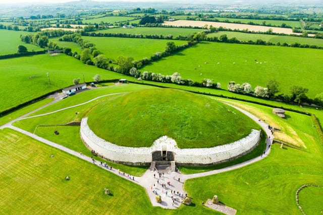 Fairy fort / earthen ringfort in NewgrangeFairy fort / earthen ringfort · 174 yd
 DronehengeArchaeological place · 264 yd
 NewgrangeHeritage attraction · 842 yd
 Mill Housemill (water) · 1076 yd
 Boyne Currach CentreHeritage attraction · 1160 yd
 Catholic Church of the Nativity of Our Ladychurch/chapel · 1727 yd
 Knowth Fox CovertWood · 1.1 mi
 Brú na Bóinne Visitors CentreVisitor information · 1.1 mi
 Dowth CastleCastle, tower house · 1.6 mi
 Glenmore ForestWood · 2.3 mi
 Proudfootstown CastleCastle, unclassified · 2.6 mi
 RiverviewMemorial · 3.0 mi
Other information
Photo: Credit not shown in the picture search · Rights wording not checked; contact us if this picture should be removed