What is recorded here
Located in waterlogged moorland. An aerial photograph (BKS 2744062/3) shows a cropmark of circular ditched feature (diam. c. 20m). Located within a very boggy field which had been ploughed but is now under rough grass and waterlogged. Extensive drainage ditches in the vicinity. Not visible at ground level.
From the National Monuments Service (Archaeological Survey of Ireland) record DU005-014
The monument record does not grant public access. Check the route and ask the landowner before entering private land.
- What survives
- Recorded monument
Places near here
Photo credits
- National Inventory of Architectural Heritage
- Offdaw, Wikimedia Commons · CC BY-SA 4.0
- Jonjobaker, Wikimedia Commons · CC BY-SA 4.0
- GsmithEIDW at English Wikipedia, Wikimedia Commons · Public domain
Wavin LakesNature reserve · 230 ydRing-ditch in CullenhillRing-ditch · 406 yd‘Pigeon Ho.’Dovecote · 416 yd Tara HouseRectory/glebe/vicarage/curate's house · 452 ydBalrothery TowerCastle · 566 ydChurch in BalrotheryChurch · 567 ydBalrothery Heritage CentreMuseum · 581 ydFlat cemetery in DarcystownFlat cemetery · 952 ydCastle (remains of)Castle, tower house · 1516 ydBarn WoodWood · 1.3 miBbq AreaPicnic place · 1.5 miArdgillan CastleHeritage attraction · 1.5 mi
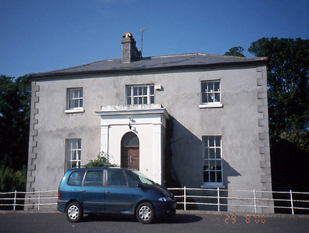 Tara HouseRectory/glebe/vicarage/curate's house · 452 yd
 Balrothery TowerCastle · 566 yd
 Church in BalrotheryChurch · 567 yd
 Balrothery Heritage CentreMuseum · 581 ydFlat cemetery in DarcystownFlat cemetery · 952 ydCastle (remains of)Castle, tower house · 1516 ydBarn WoodWood · 1.3 miBbq AreaPicnic place · 1.5 mi
 Ardgillan CastleHeritage attraction · 1.5 mi
More archaeology and monuments in County Dublin · All of County Dublin
What do you know about this place?