DDiscover AloneMapAbout

Ring-ditch in Croom

Ring-ditch
Computer-made picture that does not show Ring-ditch in CroomNot a photo of this monument
Computer-made picture. It does not show this monument. · Report the wrong picture

The monument record does not grant public access. Check the route and ask the landowner before entering private land.

What do you know about this place?Tap to add a comment or ask a question

What you write will be public.

What is recorded here

Situated on the route of the Croom Bypass, 100m W of the River Maigue and which also marks a townland boundary with Tooreen. Not depicted on OSi historic maps. Levelled monument identified by Celie O’Rahilly, Limerick County Archaeologist in advance of construction of the Croom bypass and described as: ‘a circular…

Read the whole record
Situated on the route of the Croom Bypass, 100m W of the River Maigue and which also marks a townland boundary with Tooreen. Not depicted on OSi historic maps. Levelled monument identified by Celie O’Rahilly, Limerick County Archaeologist in advance of construction of the Croom bypass and described as: ‘a circular platform of raised ground, measuring 24m diameter’. Archaeological testing in 1997 under licence No. 97E0399 was subsequently carried out by Thaddeus Breen and the results of the testing were summarised as following: ‘A circular, ditched enclosure with possible associated features outside the ditch (Breen 1998, 113). The ring-ditch was fully excavated (Licence No. 97E0399 ext.) and monitoring of topsoil to N and S was carried out by Fiona Rooney in 1999 and the results of the excavation were summarised as following: ‘The remains of a ring-ditch consisting of a subcircular central area measuring 33.3m north-south by 31.4m, raised c. 0.4m above the surrounding ground. This was enclosed by a ditch that had been reused in more recent times for land reclamation purposes. Removal of the sod and topsoil revealed the upper fills of a ditch and drain feature and an area of archaeological activity in the central raised area. During excavations it was found that the ditch had been greatly disturbed by a series of drains that followed the line of the ring-ditch. Here the stratigraphy consisted of a layer of orange/grey, silty clay overlying the stone drains. The original cut of the ditch had been altered by this disturbance. The basal fill of the ditch survived below the drains and contained inclusions of animal bone. In the east of the site (along the road boundary) an area 20m long had not been disturbed by land reclamation, and here the ditch and entranceway survived. The original ditch cut was 2.8m wide and c. 1m in maximum depth. Removal of the orange/grey, silty clay layer revealed the basal layer of the ditch and a deposit of stones in the north and south terminals. The deposit of stones contained inclusions of animal bone, charcoal flecks and a fragment of a lignite bracelet. The ditch was U-shaped in section. In the eastern half of the central raised area the remains of a possible structure were revealed. It was defined by two linear slot-trenches, both of which ran in an east-west direction. The fill of the trenches was a stony, grey/brown, silty clay with coarse components of animal bone and animal teeth. Within the area defined by the slot-trenches a number of shallow pits and post-holes were revealed. A scatter of cremated bone was also revealed below the topsoil within the dark, blackish-brown, silty clay deposit. Finds from the site included modern pottery, glass and clay pipe fragments, which came from the ditch, the drains and the topsoil. Coarse components from the structure consisted primarily of animal bone, some cremated bone and the occasional fragment of slag. A small pin was found in the disturbed area of the ditch, and a fragment of a lignite bracelet was discovered in the undisturbed context in the south terminal. Monitoring of the mechanical excavation of the topsoil revealed a number of drains, some of which were the same as those found during the manual excavation of the ring-ditch. Some of the drains appeared to run below the level of the road, therefore pre-dating its construction. Altogether, eleven drains were revealed: five ran in a north-south direction and were machine cut, two ran in an east-west direction, and the others ran along the line of the ring-ditch; all were manually cut. Modern glazed pottery fragments were the only coarse components revealed during the excavation of the drains’ (Rooney 2000, 164). Levelled monument has been completely excavated and is not visible on Google Earth orthoimage taken 28/06/2018. See attached Google Earth orthoimage Compiled by: Alison McQueen and Vera Rahilly Date of upload: 23 October 2020

From the National Monuments Service (Archaeological Survey of Ireland) record LI030-135

Places near here

Photo credits
  • National Inventory of Architectural Heritage
  • Willow, Wikimedia Commons · CC BY 2.5
  • PAUL FARMER, Geograph · CC BY-SA 2.0
  • Maker not stated on source page, www.goirishtours.com
  • Kmcnamee, Wikimedia Commons · CC BY-SA 4.0
  • Maker not stated on source page, www.dreamstime.com
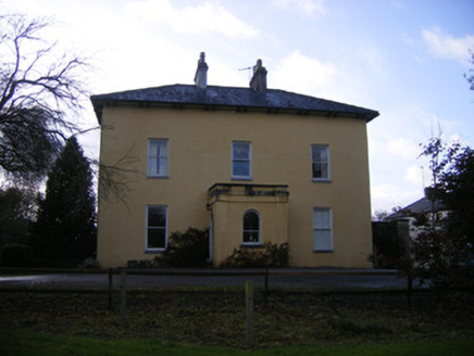
The Old RectoryRectory/glebe/vicarage/curate's house · 241 yd

Explorer Tom The Old Rectory in Anhid West started because two lads bet in the pub that they could build it faster than the sun…

IslandmoreCountry house · 438 yd

Explorer Tom Islandmore in Tooreen bragged about surviving a storm where the sky turned purple and the stables held firm. It’s a…

European ash725 yd

Explorer Tom European ash saw the most dramatic event when a squirrel dropped a nut on a priest’s head. It stands tall in Limerick…

Anhid HouseHouse · 793 yd

Explorer Tom Anhid House in Anhid is trying to explain the 1800s to a teenager who thinks uPVC windows are high art. It’s got that…
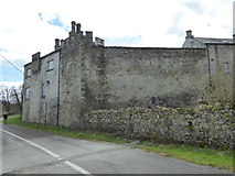
CastleCastle, Anglo-Norman masonry castle · 878 yd

Explorer Tom Castle in Croom loves singing 'Greensleeves' because it thinks it’s a medieval romance novel and not just a stone pile.…

Coom CastleCastle · 879 yd

Explorer Tom Coom Castle in County Limerick has an imaginary fan club that meets every Tuesday to argue about who left the gate open…

Croom CastleHouse · 882 yd

Explorer Tom Croom Castle in Croom has a hidden message in its stones that just says 'buy more paint'. It sits inside a medieval…
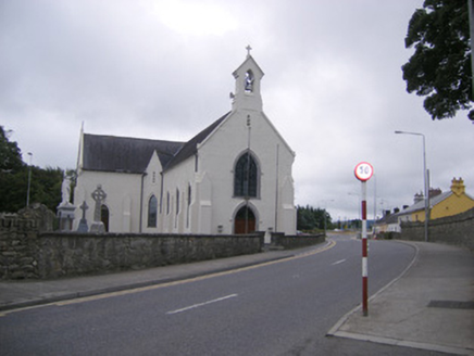
Catholic Church of Saint Mary of the AssumptionChurch/chapel · 951 yd

Explorer Tom Saint Mary's Church in Croom had a fairy dispute over who got parking rights next to the bell tower. It’s all Gothic…

Páirc Na nGael Cromadh, CroomGAA ground · 1008 ydAnhid CemeteryCemetery · 1046 yd

Explorer Tom Anhid Cemetery is run by a very serious dog who hasn't seen a human in years. He guards the gate with intense suspicion…

Croom MillsMill (water) · 1051 yd

Explorer Tom Croom Mills in Croom would put 'Finally Got Some Sleep' right on its headstone. That wheel from Cork has been spinning…

Saint Mary's PresbyteryPresbytery/parochial/curate's house · 1065 yd

Explorer Tom Saint Mary's Presbytery thinks tourists from Dublin are all wind and no substance, like over-baked scones. Its canted…

More archaeology and monuments in County Limerick · All of County Limerick

Add to this placeAdd a picture Add a detailed tip Add a story

Explore the map1,095,414 places to discover

Next place · or swipeThe Old Rectory