What is recorded here
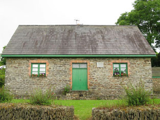
Detached three-bay double-height former national school, built c.1860, having lean-to addition to rear (south). Now in use as pair of houses. Pitched slate roof having rubble limestone chimneystack, timber clad eaves course and recent rooflights. Rubble limestone walls having rubble limestone plinth and tooled limestone name plaque to front (north). Square-headed window openings with slate sills to front elevation, having red brick block-and-start surrounds, red brick voussoirs and timber casement windows. Pointed arch window openings with slate sills to side (east, west) elevations, having red brick block-and-start surrounds, red brick voussoirs and timber casement windows. Square-headed loop style openings to rear elevation of lean-to having slate lintels. Square-headed door opening with red brick block-and-start surround to front elevation, having red brick voussoirs and double-leaf timber battened doors, overlights and stepped approach. Square-headed door openings to side (east, west) elevations of lean-to having cast-iron lintels and timber battened doors. Recent rubble limestone enclosing walls having stepped approach from gate. Freestanding cast-iron water pump with cylindrical shaft and raised horizontal banding within grounds set in rubble stone plinth.
This former national school is an excellent example of the type and scale of mid-nineteenth century school buildings that are often found in small towns and rural communities. Of compact design, it utilises quality building materials, and its original form and character remaining intact. The carved stone name plaque acts as a reminder of the social and educational function it once served within the local community.
From the Buildings of Ireland (National Inventory of Architectural Heritage) record 20911301
This does not grant access. Most recorded buildings are privately owned; view them only from public ground unless the owner allows entry.
Places near here
Photo credits
- Juergen Meuer, Geograph · CC BY-SA 2.0
- John M, Geograph · CC BY-SA 2.0
- National Inventory of Architectural Heritage
- Jonathan Thacker, Geograph · CC BY-SA 2.0
- Jonathan Thacker, Geograph · Creative Commons Attribution-ShareAlike 2.0
- The Speckled Bird, Wikimedia Commons · CC BY-SA 4.0
 Taoide MharaRuins · 957 yd
 Nohaval CoveBeach / strand · 1002 yd
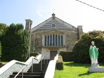 St Patrick's Roman Catholic ChurchChurch/chapel · 1259 ydBarrys Castle (Site of)Castle, unclassified · 1.5 miCreek Newfoundland BsyViewpoint · 1.5 miNew Foundland Bay viewViewpoint · 1.6 miKinure Castle (Site of)Castle, unclassified · 2.4 mi
 Rocky BayBeach / strand · 2.5 miSovereign IslandIslet · 3.6 mi
 Grave YardGraveyard · 3.7 miGreat Sovereign IslandIsland · 4.3 mi
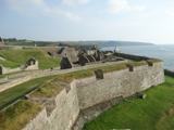 Charles FortBastioned fort · 5.2 mi
More historic places in County Cork · All of County Cork
What do you know about this place?