
What is recorded here
On E side of road, land falls away steeply to E; rectangular graveyard (c. 40m N-S; c. 25m E-W) enclosed to E, S and W by stone-faced earthen bank and to N by stone wall and ruined parish church of Kilpatrick (CO099-04002-); partially overgrown. Filled with N-S rows of low uninscribed gravemarkers; three inscribed headstones, one dated 1790, two recent.
From the National Monuments Service (Archaeological Survey of Ireland) record CO099-040001
The monument record does not grant public access. Check the route and ask the landowner before entering private land.
- What survives
- Recorded monument
Places near here
Photo credits
- Hywel Williams, Wikimedia Commons · CC BY-SA 2.0
- National Inventory of Architectural Heritage
- Mike Searle, Geograph · CC BY-SA 2.0
- Jonathan Thacker, Geograph · CC BY-SA 2.0
- Honourablemencandiffer, Wikimedia Commons · Public domain
- Guliolopez, Wikimedia Commons · CC BY-SA 3.0
- Greg Clarke, Wikimedia Commons · CC BY 2.0
- Rob Hodgkins, Wikimedia Commons · CC BY-SA 2.0
 Kilpatrick Church (in Ruins)Church · 24 ydFulacht fia in Kilpatrick (kinalea By.)Fulacht fia · 193 yd
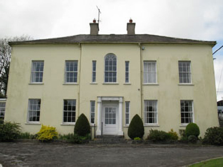 Willowhill HouseHouse · 527 ydCastle (in Ruins)Castle, tower house · 2.5 miCoolmore WoodWood · 3.0 mi
 Ballea CastleCastle, tower house · 3.6 mi
 Rocky BayBeach / strand · 3.6 mi
 Myrtleville BeachBeach / strand · 3.7 miLoughbeg Bird ReserveNature reserve · 3.8 mi
 Camden Fort MeagherHeritage attraction · 4.9 mi
 Camden FortFortification · 5.0 mi
_(40783618904).jpg/250px-Manx2_EC-ITP_Metro_EMA(5)_(40783618904).jpg "Photo: Rob Hodgkins, Wikimedia Commons · CC BY-SA 2.0") Manx2 Flight 7100Aviation accident · 6.6 mi
Manx2 Flight 7100Aviation accident · 6.6 miMore archaeology and monuments in County Cork · All of County Cork
What do you know about this place?