
What is recorded here
Occupying high ground and steeply-sloping W side of outer entrance to Cork harbour; directly opposite is Carlisle Fort (CO087-058---). Phillips's map of 1685 (Gowen 1979, 231) shows no fortification on this headland but depicts small shoreline blockhouse/battery further south in vicinity of Weaver's point; Goubet's map of c. 1690 (ibid., 250; Kerrigan 1980, 14; O Murchadha 1990, 4) shows two lines of walls or revetments apparently pierced by gun embrasures along shoreline and square bastioned fort in approximate position of later fort, these probably constituted 'James's Battery' erected by forces of James II and which engaged Williamite navy in 1690. Unclear if any of these features incorporated into Camden Fort which was built c. 1798. Plan on 1842 OS 6-inch map shows roughly rectangular area enclosed on landward sides by zig-zag ditch with 'irregular tenaille trace' on its inside (Kerrigan 1978, 147); plan also shows ranges of barrack buildings and shoreline gun emplacements. 1804 report lists 26 pieces of ordnance here (Kerrigan ibid.) but by 1837 'had but a token force of a master-gunner and five men' (O Murchadha 1967, 67). About 1870 (Kerrigan ibid.) landward defences remodelled when wide, deep ditch constructed on irregular zig-zag plan, with caponier. Also about this time shoreline works built including two piers and Brennan torpedo emplacement (O Murchadha 1967, 69) and 'new gun emplacements towards the harbour entrance' (Kerrigan ibid). Fort area honeycombed with underground passages and emplacements, including a large magazine. Handed over to Irish government in 1938 and renamed Dún Uí Mheachair (Fort Meagher). Now owned by Cork County Council who plan to open it as 'interpretive centre'. According to Lewis (1837, vol. 2, 602) excavations for fort destroyed 'a nearly perfect tumulus' -perhaps comparable with nearby tumulus at Curraghbinny (CO099-023---).
Occupying high ground and steeply-sloping W side of outer entrance to Cork harbour; directly opposite is Carlisle Fort (CO087-058---). Phillips's map of 1685 (Gowen 1979, 231) shows no fortification on this headland but depicts small shoreline blockhouse/battery further south in vicinity of Weaver's point; Goubet's map of c. 1690 (ibid., 250; Kerrigan 1980, 14; O Murchadha 1990, 4) shows two lines of walls or…
From the National Monuments Service (Archaeological Survey of Ireland) record CO099-024
The monument record does not grant public access. Check the route and ask the landowner before entering private land.
- What survives
- Recorded monument
Places near here
Photo credits
- National Inventory of Architectural Heritage
- Guliolopez, Wikimedia Commons · CC BY-SA 3.0
- Andrew Wood, Geograph · CC BY-SA 2.0
- Jonathan Thacker, Geograph · CC BY-SA 2.0
- Tim FitzGerald, Geograph · CC BY-SA 2.0
- Caoimheen3, Wikimedia Commons · CC BY-SA 4.0
- Kondephy, Wikimedia Commons · CC BY-SA 4.0
- Honourablemencandiffer, Wikimedia Commons · Public domain
- Garry Dickinson, Geograph · CC BY-SA 2.0
- derek menzies, Wikimedia Commons · CC BY-SA 2.0
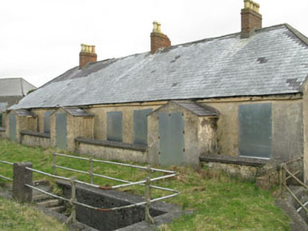 Camden Fort MeagherBarracks · 42 yd
 Camden Fort MeagherOfficers' mess · 75 yd
 Camden Fort MeagherHeritage attraction · 141 ydCastle (Site of)Castle, unclassified · 1241 yd
 Church Bay BeachBeach / strand · 1678 yd
 Curraghbinny WoodsForest · 1.0 mi
 Roches PointHeadland · 1.4 mi
 Burial ground in Spike IslandBurial ground · 1.7 mi
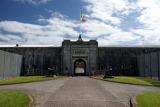 Spike IslandIslet · 1.8 mi
 Myrtleville BeachBeach / strand · 2.0 mi
 Martello Tower2.0 mi
.jpg/250px-Rocky_Island_(geograph_3666538).jpg "Photo: derek menzies, Wikimedia Commons · CC BY-SA 2.0") Rocky IslandIslet · 2.3 mi
Rocky IslandIslet · 2.3 miMore archaeology and monuments in County Cork · All of County Cork
What do you know about this place?