What is recorded here
On flat ground on the E bank of the Clashawley river with Rathcool motte (TS070-008---) located c. 25m to the S and Rathcool church (TS070-009----) and graveyard (TS070-009001-) 350m to the S. According to the Civil Survey (1654-56), the 'lands of Rathcoole, Farrenmabin, Cuarraghscartin Bellavady & Garryduffe...hath on it a Castle a Thatcht house, an old Oarchard & a Garden with sev[er]all small Cottages & the Rivolett Glassalin run[n]ing through it', with 'James Lord Barron of Dunboyne Irish Papist' the proprietor in 1640 (Simington 1931, vol. 1, 191). The 2nd (1903-04) ed. 6-inch OS map indicates that Rathcoole house is on the site of Rathcoole Castle (TS070-007001-). Rathcoole house is a two-phase building, the earlier two-storey six-bay house (L 28.7m; Wth 4.6m; wall T 0.5-0.65m) runs roughly N-S while a later mid-18th century block runs eastward from the S end of the earlier house. The two-story house is one room deep, though a corridor runs from the kitchen along the W wall giving access to other rooms. The southern end of the house probably originally was built up against the wall of a castle, the N wall of which still survives. The original large fireplace in the kitchen was modified during renovations and a cut limestone architectural fragment, probably from the castle and of 16th-century date, was recovered from the stonework of the chimney. The two-storey house has three brick chimneys, all later insertions.
Compiled by: Jean Farrelly
Date of upload: 23 March 2012
The monument record does not grant public access. Check the route and ask the landowner before entering private land.
- What survives
- Recorded monument
Places near here
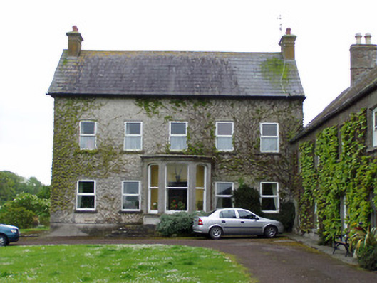 Rathcoole Castlehouse · 19 yd
 IndicatedCastle, motte · 57 yd
 Rathcool Church (in ruins)Church · 434 yd
 CastleCastle, ringwork · 1140 yd
 RathavinFairy fort / earthen ringfort · 1206 yd
 Enclosure in AnnesgiftEnclosure · 1616 yd
 Kilknockan HillMountain / peak · 1.4 mi
 European YewEuropean Yew · 1.7 mi
 East GateMemorial · 1.8 mi
 Grove WoodForest · 2.8 mi
 Eagle HillMountain / peak · 5.5 mi
 Rocklow Househouse · 750 yd