Places near here
Photo credits
- National Inventory of Architectural Heritage
- N Chadwick, Wikimedia Commons · CC BY-SA 2.0
- Mike Searle, Geograph · CC BY-SA 2.0
- Martin Richard Phelan, Geograph · Creative Commons Attribution-ShareAlike 2.0
- Sitomon, Wikimedia Commons · CC BY-SA 2.0
- A.-K. D., Wikimedia Commons · CC BY-SA 4.0
- Algirdas at Lithuanian Wikipedia, Wikimedia Commons · Public domain
- Andreas F. Borchert, Wikimedia Commons · CC BY-SA 4.0
- Chmouel Boudjnah Original uploader was Chmouel at fr.wikipedia, Wikimedia Commons · CC BY-SA 3.0
- Benutzer:StefanServos, Wikimedia Commons · CC BY-SA 3.0
 bridge952 yd
Explorer Tom Bridge in Ballybough is doing its best impression of a zombie apocalypse survivor, standing on that bend like it’s got all the time in the world. The stones are holding firm against the undead horde, but honestly, I think it’s just waiting for someone to offer it a proper snack. You’ll want to snap a pic from the roadside before it sneezes itself into history.
 Rocklow HouseHouse · 1099 yd
Explorer Tom Rocklow House is standing there all tall and imposing, which annoys the wind because it keeps picking on the big chimneys. The wind hates it when a house shows off its verticality without any apology, so it just howls at the porch instead of saying hi nicely. Look out for the limestone arcade if you are feeling brave enough to peek.
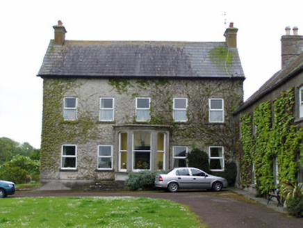 Rathcoole CastleHouse · 1198 yd
Explorer Tom Rathcoole Castle would spend its lotto win on a bigger porch because right now it feels like the focal point is missing some punch. It sits with a motte and castle remains, which makes it feel like a grandfather who tells stories about his younger, rougher self. If the farm dogs bark, they’re just telling jokes.
 Cramps Castle (in ruins)Castle, hall-house · 1.6 mi
Explorer Tom Cramps Castle is on a ridge where you might get a cramp if you don’t wave at it first, so be polite. The curse only hits people who are rude to stone walls, apparently. Go before the tourists find out.
 Court CastleCastle · 1.7 mi
Explorer Tom Court Castle thinks it replaced by a Tesco Express would be an insult to its medieval dignity and fine bones. Tell the new shop that its aisles lack proper atmosphere and historical grime. Ideal place to rehearse an excuse for being late.
 Grave YardGraveyard · 1.7 mi
Explorer Tom Graveyard in Fethard had a fiddler who played there all night until the stones started dancing. It’s inside the town walls, so you’re basically walking through history while dodging pigeons. Bring wellies and low expectations, leave delighted.
 European Yew1.7 mi
Explorer Tom This European Yew in County Tipperary claims to hold the world record for looking the most unbothered by everything happening around it. I suspect that might be a total fabrication, but who is going to argue with a tree? Ideal for a moody photo you'll pretend wasn't posed.
 Sheela-na-gig in FethardSheela-na-gig · 1.7 mi
Explorer Tom Sheela-na-gig in Fethard thinks tourists from Dublin dress like they’ve never seen rain or mud before, which is hilarious to her. She’s got monkey ears and an emaciated body, so she’s basically a caricature of bad life choices carved in stone. Bring a camera and your most suspicious face.
 Pedunculate Oak3.0 mi
Explorer Tom Pedunculate Oak in County Tipperary is currently being managed by a very aggressive dog who barks at anyone who comes too close to its trunk. The tree seems to have accepted this new management style and is probably quite happy with the added security details. Grand place for a sulk or a snog, your call.
 Caher AbbeyHeritage attraction · 12 mi
Explorer Tom Caher Abbey in County Tipperary is secretly proud of one specific potato that grew near its wall and somehow survived the famine despite all odds. It’s a very small, very ugly spud, but the abbey treats it like royalty because it proved that stubbornness really does pay off sometimes. Wave at the cows, they're the real locals.
 Siege of Cahir CastleSiege · 12 mi
Explorer Tom The Siege of Cahir Castle happened when someone got really angry about walls and probably ran out of bread. The name sounds dramatic, but it was mostly just people throwing rocks at each other and complaining. The castle is still there, pretending it didn’t get a bit of chipping. Pick a stone, any stone, and invent its biography.
 Cahir CastleCastle · 12 mi
Explorer Tom Cahir Castle's first owner planned to escape via a moat that was mostly just wet mud. It’s the ultimate 'I meant to do it better' architectural choice. Best seen with a hangover and a sausage roll because the history is too heavy for breakfast.
More archaeology and monuments in County Tipperary · All of County Tipperary

What do you know about this place?Tap to add a comment or ask a question