What is recorded here
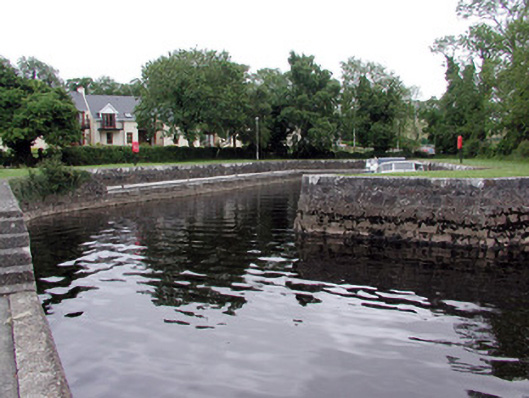
Limestone quay, built c.1840, on the River Shannon. Battered walls of squared blocks. Cast-iron mooring posts. Stone steps to water. Limestone conical navigation post to west of quay.
Dromod Quay, located on the River Shannon, is a mid-nineteenth century sheltered quay that provides protection to moored boats. The quay forms a notable group of inland navigation features with the navigation post.
From the Buildings of Ireland (National Inventory of Architectural Heritage) record 30818022
This does not grant access. Most recorded buildings are privately owned; view them only from public ground unless the owner allows entry.
Places near here
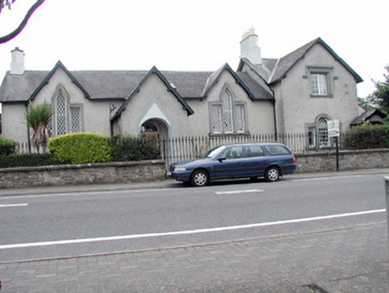 Warren LodgeSchool · 395 yd
 water pump446 yd
 Cavan & Leitrim RailwayMuseum · 823 ydInchmurrin or Rabbit IslandIslet · 1219 ydOtter IslandIslet · 1479 ydLiscromaunFairy fort / earthen ringfort · 1.4 mi
 Grave YardGraveyard · 3.3 miCastleCastle, tower house · 3.9 mi
 Western Hemlock4.0 mi
 Monkey-puzzle4.0 mi
 Lough Rynn HouseCastle · 4.1 miTom Dunphy MemorialMemorial · 5.2 mi
Pictures: National Inventory of Architectural Heritage; P L Chadwick, Geograph · CC BY-SA 2.0; Reading Tom, Wikimedia Commons · CC BY 2.0; Davidcorry200, Wikimedia Commons · CC BY-SA 4.0; Doug Kerr from Albany, NY, United States, Wikimedia Commons · CC BY-SA 2.0; Vicente Fernández Rioja, Wikimedia Commons · CC BY-SA 4.0; SE Keenan, Wikimedia Commons · CC BY-SA 4.0
More historic places in County Leitrim · All of County Leitrim
What do you know about this place?