What is recorded here
From the National Monuments Service (Archaeological Survey of Ireland) record WM001-024
Places near here
Picture notes
- National Inventory of Architectural Heritage
- Gavigan 01 at English Wikipedia, Wikimedia Commons · CC BY 2.5
- Colin Park, Geograph · CC BY-SA 2.0
- Computer-made picture. It does not show this walking route.
- Computer-made picture. It does not show this holy well.
- Britishfinance, Wikimedia Commons · CC BY-SA 4.0
- Mike Searle, Geograph · CC BY-SA 2.0
- Malene Thyssen, Wikimedia Commons · CC BY-SA 3.0
- Cavanphotography, Wikimedia Commons · CC BY-SA 4.0
- Kieran Campbell, Geograph · CC BY-SA 2.0
- Willow, Wikimedia Commons · CC BY 2.5
 Balnacart MillMill (water) · 126 yd
Explorer Tom Balnacart Mill has caught my eye in Foyran, County Westmeath. I bet a mill (water) with a name like that could keep me talking all afternoon; I'm already inventing a daft little scene for it, and I'll stop before it turns into history.
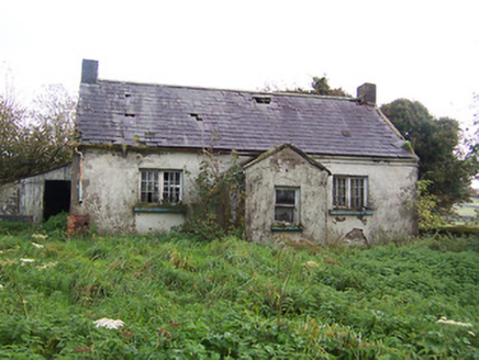 Tullystown National SchoolSchool · 1178 yd
Explorer Tom Tullystown National School has caught my eye in Tullystown, County Westmeath. I bet a school with a name like that could keep me talking all afternoon; I'm already inventing a daft little scene for it, and I'll stop before it turns into history.
 MullaghmeenMountain / peak · 1468 yd
Explorer Tom Mullaghmeen has caught my eye in County Westmeath. I bet a mountain / peak with a name like that could keep me talking all afternoon; I'm already inventing a daft little scene for it, and I'll stop before it turns into history.
 Mullaghmeen White WalkWalking route · 1575 yd
Explorer Tom Mullaghmeen White Walk has caught my eye in County Westmeath. I bet a walking route with a name like that could keep me talking all afternoon; I'm already inventing a daft little scene for it, and I'll stop before it turns into history.
 Mullaghmeen Blue WalkWalking route · 1.0 miComputer-made picture. It does not show this walking route.
Explorer Tom Mullaghmeen Blue Walk has caught my eye in County Westmeath. I bet a walking route with a name like that could keep me talking all afternoon; I'm already inventing a daft little scene for it, and I'll stop before it turns into history.
 Holy well in BigwoodHoly well · 1.2 miComputer-made picture. It does not show this holy well.
Explorer Tom Holy well in Bigwood has caught my eye in Bigwood, County Westmeath. I bet a holy well with a name like that could keep me talking all afternoon; I'm already inventing a daft little scene for it, and I'll stop before it turns into history.
 Mullaghmeen ForestPicnic place · 1.5 mi
Explorer Tom Mullaghmeen Forest has caught my eye in County Westmeath. I bet a picnic place with a name like that could keep me talking all afternoon; I'm already inventing a daft little scene for it, and I'll stop before it turns into history.
 Ross CastleCastle, tower house · 2.8 mi
Explorer Tom Ross Castle has caught my eye in Ross, County Meath. I bet a castle, tower house with a name like that could keep me talking all afternoon; I'm already inventing a daft little scene for it, and I'll stop before it turns into history.
 European Beech3.6 mi
Explorer Tom European Beech has caught my eye in County Meath. I bet a european beech with a name like that could keep me talking all afternoon; I'm already inventing a daft little scene for it, and I'll stop before it turns into history.
 Myles O'Reilly MonumentMemorial · 3.7 mi
Explorer Tom Myles O'Reilly Monument has caught my eye in County Westmeath. I bet a memorial with a name like that could keep me talking all afternoon; I'm already inventing a daft little scene for it, and I'll stop before it turns into history.
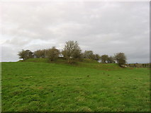 Fairy fort / earthen ringfort in Garrysallagh (o'reilly)Fairy fort / earthen ringfort · 4.3 mi
Explorer Tom This is the largest of four Garrysallagh ringforts, featuring three banks surrounding an interior of twenty-nine meters in diameter.
 European ash4.3 mi
Explorer Tom European ash has caught my eye in County Westmeath. I bet a european ash with a name like that could keep me talking all afternoon; I'm already inventing a daft little scene for it, and I'll stop before it turns into history.
More archaeology and monuments in County Westmeath · All of County Westmeath

What do you know about this place?Tap to add a comment or ask a question