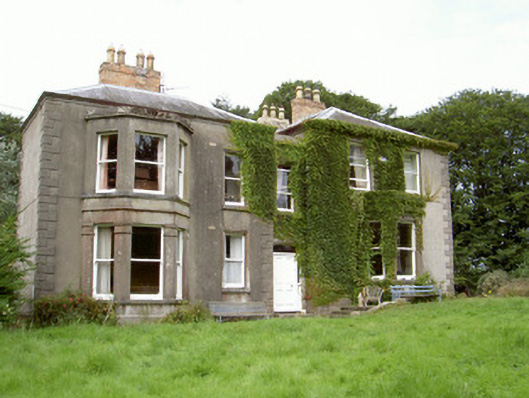
What is recorded here
Detached three-bay two-storey house, built 1886, on a T-shaped plan originally three-bay two-storey on a rectangular plan centred on single-bay two-storey pedimented projecting breakfront; pair of two-bay two-storey returns (south). Vacant, 1901. Occupied, 1911. Hipped slate roof on a T-shaped plan centred on pitched…
Read the whole record
From the Buildings of Ireland (National Inventory of Architectural Heritage) record 13900603
Places near here
Picture notes
- Computer-made picture. It does not show this monument.
- National Inventory of Architectural Heritage
- Eric Jones, Geograph · CC BY-SA 2.0
- Computer-made picture. It does not show this walking route.
- Dundalk99, Wikimedia Commons · CC BY-SA 4.0
- Computer-made picture. It does not show this playground.
 IndicatedGraveyard · 299 ydComputer-made picture
Explorer Tom Graveyard in Philipstown has caught my eye in Philipstown, County Louth. I bet a graveyard with a name like that could keep me talking all afternoon; I'm already inventing a daft little scene for it, and I'll stop before it turns into history.
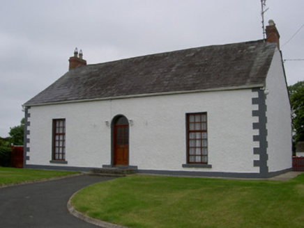 Slieve CottageFarm house · 639 yd
Explorer Tom Slieve Cottage has caught my eye in Slieve, County Louth. I bet a farm house with a name like that could keep me talking all afternoon; I'm already inventing a daft little scene for it, and I'll stop before it turns into history.
 Fairy fort / earthen ringfort in RathmoreFairy fort / earthen ringfort · 676 ydComputer-made picture
Explorer Tom Fairy fort / earthen ringfort in Rathmore has caught my eye in Rathmore, County Louth. I bet a fairy fort / earthen ringfort with a name like that could keep me talking all afternoon; I'm already inventing a daft little scene for it, and I'll stop before it turns into history.
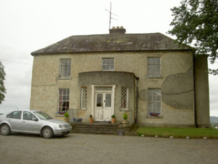 Barronstown RectoryRectory/glebe/vicarage/curate's house · 706 yd
Explorer Tom Barronstown Rectory has caught my eye in Philipstown, County Louth. I bet a rectory/glebe/vicarage/curate's house with a name like that could keep me talking all afternoon; I'm already inventing a daft little scene for it, and I'll stop before it turns into history.
 Roche CastleCastle, Anglo-Norman masonry castle · 1.2 mi
Explorer Tom Roche Castle has caught my eye in Roche, County Louth. I bet a castle, anglo-norman masonry castle with a name like that could keep me talking all afternoon; I'm already inventing a daft little scene for it, and I'll stop before it turns into history.
 The Poets' Trail - Creggan RouteWalking route · 2.0 miComputer-made picture
Explorer Tom The Poets' Trail - Creggan Route has caught my eye in County Louth. I bet a walking route with a name like that could keep me talking all afternoon; I'm already inventing a daft little scene for it, and I'll stop before it turns into history.
 Castletown MotteArchaeological place · 2.5 mi
Explorer Tom Castletown Motte has caught my eye in County Louth. I bet a archaeological place with a name like that could keep me talking all afternoon; I'm already inventing a daft little scene for it, and I'll stop before it turns into history.
 Ballsmill Amenity LandPicnic place · 2.5 mi
Explorer Tom Ballsmill Amenity Land sits right where Ballsmill Road meets Glasdrumman Road, perfect for a riverside picnic and a chat.
 The Poets' Trail - Forkhill RouteWalking route · 3.1 miComputer-made picture
Explorer Tom The Poets' Trail - Forkhill Route has caught my eye in County Louth. I bet a walking route with a name like that could keep me talking all afternoon; I'm already inventing a daft little scene for it, and I'll stop before it turns into history.
 Dundalk CentralHeritage attraction · 3.5 mi
Explorer Tom Dundalk Central has caught my eye in County Louth. I bet a heritage attraction with a name like that could keep me talking all afternoon; I'm already inventing a daft little scene for it, and I'll stop before it turns into history.
 Newry, Mourne and Down District CouncilChildren's playground · 3.6 miComputer-made picture
Explorer Tom This Newry, Mourne and Down District Council playground is surely a community favorite for happy playtimes.
 TievecromMountain / peak · 3.9 mi
Explorer Tom Tievecrom used to host a sophisticated watch tower called Romeo 23, so let's imagine what life was like guarding that strategic spot.
More historic places in County Louth · All of County Louth

What do you know about this place?Tap to add a comment or ask a question