What is recorded here
Fairy forts are not fairy forts at all. They are human ringforts, misnamed because people stopped remembering the hands that built them. Rathmore is one of them: a circular enclosure with two banks, a deep foss between them, and a gap in the outer bank at the northwest. It may also have had an underground passage inside. The land was levelled in 1966, so much of its shape is gone, but the naming still does its work. It takes a human home and makes it sound like a place where sense withdraws.
The following description is derived from both the published 'Archaeological Inventory of County Louth' (Dublin: Stationery Office, 1986) and the 'Archaeological Survey of County Louth' (Dublin: Stationery Office, 1991). In certain instances the entries have been revised and updated in the light of recent research.
Date of upload/revision: 17 July 2007
From a preliminary field visit in 1965 it was noted that this was a circular area enclosed by two banks with wide, deep intervening fosse. Entrance gap in outer bank at NW. Possible Man-made underground passage (LH006-017002-) in interior. Levelled in 1966, prior to detailed survey.
The monument record does not grant public access. Check the route and ask the landowner before entering private land.
- What survives
- Recorded monument
Places near here
 Philipstown ChurchChurch · 455 yd
 Enclosure in RathmoreEnclosure · 664 yd
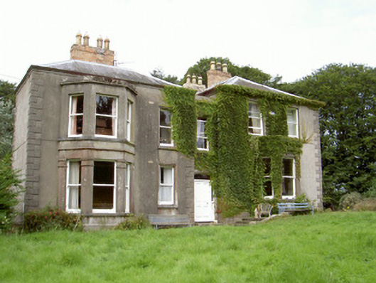 Philipstown Househouse · 676 yd
 Man-made underground passage in BalrobinMan-made underground passage · 1069 yd
 CastleCastle, unclassified · 1.1 mi
 Bawn in Shortstone EastBawn · 1.1 mi
 Sky HillMountain / peak · 2.3 mi
 Ballsmill Amenity LandPicnic place · 2.9 mi
 Dundalk CentralHeritage attraction · 3.3 mi
 Photo GalleryHeritage attraction · 3.3 mi
 Maid of ErinMemorial · 3.7 mi
 Bombing 1975Memorial · 3.7 mi