DDiscover AloneMapAbout

Penitential station in An Tearmann

Penitential station

The monument record does not grant public access. Check the route and ask the landowner before entering private land.

What do you know about this place?Tap to add a comment or ask a question

What you write will be public.

What is recorded here

Templecrone Old Church (DG048-008001-) is located inside an 18th century graveyard (DG048-008003-). 34m WSW of the graveyard wall is a turas or pilgrimage station (DG048-008002-) where dedicatory offerings are left beside a holy stone which is believed to have curative properties. 150m W of the church is a holy well…

Read the whole record
Templecrone Old Church (DG048-008001-) is located inside an 18th century graveyard (DG048-008003-). 34m WSW of the graveyard wall is a turas or pilgrimage station (DG048-008002-) where dedicatory offerings are left beside a holy stone which is believed to have curative properties. 150m W of the church is a holy well known as Tobercrone (DG048-007----). The holy stone was recorded in 1980 as 'The turas station is a rock outcrop 34m WSW of the wall enclosing Templecrone church and graveyard. Medals, coins, bottles and other objects have been placed here. The most conspicuous item here is a block of stone, circular in plan which has been shaped to give it a slight waist in the middle. Its dimensions are : 0.15m in height, 0.15-0.16m across at its base and 0.1-0.12m across at the top. The purpose and/or significance of the stone is unclear but there are two similarly shaped stones at an early church site on Tory Island, where they are said to be candles for the altar' (SMR File 1980). An earlier report from 1978 recorded that the holy stone was located in a 'cave' formed of natural boulders. Within the 'cave' there was a healing stone and votive offerings' (Kelly 2002, 26). The list of votive offerings inside the 'cave' included 'bottles, coins, household items, Christian objects, hair accessories, fragments of clothing, small souvenirs, written tracts, marine shells and pebbles' (Kelly 2002, 26). The two holy wells along with the holy stone or penitential station (DG048-008002-) and the church (DG048-008001-) and graveyard (DG048-008003-) are all associated with the turas to Templecrone. According to local information a third holy well on the island of Illancrone located 2.1km to the W, also formed part of the turas to Templecrone (pers. comm. 21/1/2011). The Turas consisted of a visit to the holy wells (DG048-007----) and to the holy stone (DG048-008002-) at Templecrone on the 7th of July which is the feastday of St Chróine, the patron saint of Templecrone church (DG048-008001-). The route and ceremony of the turas is described in the History of the Diocese of Rahpoe as, ‘The turas is performed by saying seven Our Fathers and seven Hail Marys at the Holy Well (DG048-007----), repeating the same prayers at the pile of stones (DG048-008002-) near the churchyard (DG048-008003-), and reciting the Rosary continuously while the circuit is being traversed. A portable stone (DG048-008002-), with fingermarks, as it were, impressed pretty deeply, is frequently taken away by some representative of a family among whom sickness has broken out, and, in all cases, restored after one night to the exact position in which it was found. Both the turas and St. Crone’s healing stone possess numerous clients down to the present day’ (Maguire 1920, vol.2, 222). The above description was derived from the 'Archaeological Survey of County Donegal. A description of the field antiquities of the County from the Mesolithic Period to the 17th century.' Compiled by: Brian Lacey with Eamon Cody, Claire Cotter, Judy Cuppage, Noel Dunne, Vincent Hurley, Celie O'Rahilly, Paul Walsh and Seán Ó Nualláin (Lifford: Donegal County Council, 1983).

From the National Monuments Service (Archaeological Survey of Ireland) record DG048-008002

Places near here

Photo credits
  • National Inventory of Architectural Heritage
  • Maker not stated on source page, curiousireland.ie
  • Kenneth Allen, Geograph · CC BY-SA 2.0
  • Maker not stated on source page, storage.googleapis.com
  • Maker not stated on source page, navicup.com
  • A McCarron, Wikimedia Commons · CC BY-SA 2.0
  • Maker not stated on source page, www.pinterest.com
  • Anne Burgess, Wikimedia Commons · CC BY-SA 2.0
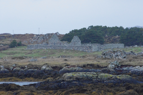
Teampall Cróine [Templecrone]Church/chapel · 53 yd

Explorer Tom Teampall Cróine [Templecrone] has stood roofless since c.1620, meaning it has spent four centuries staring straight up…
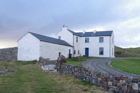
Termon HouseSteward's house · 713 yd

Explorer Tom Termon House, built around 1770, has a base that slopes outward, probably to throw rain away from its walls. A raindrop…

Portal tomb in An Roisín TheasPortal tomb · 1006 yd

Explorer Tom Portal tomb in An Roisín Theas has lost a few bricks since an artist sketched it back in the 1790s. It’s tucked into a…
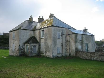
The RectoryRectory/glebe/vicarage/curate's house · 1027 yd

Explorer Tom The Rectory in Maghery Glebe was built around 1825 and looks toward Maghery Bay. If I had a desk full of paperwork…

Strand View BarPub · 1059 yd

Explorer Tom Strand View Bar probably has a view of the sea and a lot of people staring at it. It's in Donegal, where the wind tries…

EadarinisIslet · 1.2 mi

Explorer Tom Eadarinis is so small that if you sneeze too hard, it might actually jump into the next county for a holiday. Its…

Crohy TowerSignal tower · 1.2 mi

Explorer Tom Crohy Tower was built around 1805 as part of a coastal signal network watching for a possible French invasion. I would…

Inis FraoighIsland · 1.2 mi

Explorer Tom Inis Fraoigh is the larger Inishfree Island between Dungloe and Burtonport, where families once farmed and fished. I…

Lop 74Watch tower · 1.3 mi

Explorer Tom Lop 74 was a small coast watch hut erected around 1941, with a canted western half and a fireplace. From its elevated…

Lough Aghnish Promontory FortPromontory fort, inland · 1.5 mi

Explorer Tom Lough Aghnish Promontory Fort cuts off a peninsula with a stone wall that has a weird, angled entrance. The base is…

An Claondoire Burial Cairn above Lough AghnishCairn, burial cairn · 1.5 mi

Explorer Tom An Claondoire Burial Cairn above Lough Aghnish covered much of a steep hilltop when surveyed. It had several old…

CroaghnamaddyMountain / peak · 2.2 mi

Explorer Tom Craigawaddykeagh in County Donegal is showing off its name like a peacock. If it won the lotto, it’d buy a bigger hat…

More historic places in County Donegal · All of County Donegal

Add to this placeAdd a picture Add a detailed tip Add a story

Explore the map1,095,414 places to discover

Next place · or swipeTeampall Cróine [Templecrone]