DDiscover AloneMapAbout

Church in An Tearmann

Church

The monument record does not grant public access. Check the route and ask the landowner before entering private land.

What do you know about this place?Tap to add a comment or ask a question

What you write will be public.

What is recorded here

Templecrone Old Church (DG048-008001-): In ruins, in 1622 (Royal Commission, 221), the church was subsequently repaired. The church in the village of Dungloe was also known as Templecrone and this was the building described by Pococke in 1752, when he recorded that, 'we passed by Temple Crowan Church, which is a mean,…

Read the whole record
Templecrone Old Church (DG048-008001-): In ruins, in 1622 (Royal Commission, 221), the church was subsequently repaired. The church in the village of Dungloe was also known as Templecrone and this was the building described by Pococke in 1752, when he recorded that, 'we passed by Temple Crowan Church, which is a mean, low, thatched building; this Living of £80 a year is in dispute and is lapsed to the Crown' (1752, 66), it continued in use until 1829 (Rowan 1979, 268). The medieval ruins of Templecrone consist of a rectangular rubble-built church, c. 13.2m x c. 5.5m internally with secondary cross wall forming a vestibule at the W end. The N and S walls and W gable stand at full height; the former are c. 3m high. The S upper section of the E gable has fallen. This gable has a central round-headed single-light window with wide internal splay and deep plunging modern sill; the whole is evidently rebuilt. The jambs are moulded and the interior is framed by a moulded architrave of Transitional character; the returns and sill section are missing. In the SE corner of the church are two wall-presses. There are four windows in the S wall. That at the E end has a blocked-up narrow light with wide internal splay; its head is a re-used moulded fragment. The remaining windows in the S wall and the two in the N wall are simple rectangles with lintelled opes and splayed ingoings, that at the W end of the S wall is blocked up. The doorway is lintelled and bond holes for an interior wooden support beam survive. The lintel and upper section of the door in the cross-wall have fallen away. Traces of a plaster coat remain on the interior wall faces. According to a recent conservation report, traces of a 'Boylagh stone slate roof and covering appears to have been installed as part of a renovation funded by the Board of First Fruits in 1760. Stone slates were quarried relatively close by at Portnoo and at Beltany; these slates are visible scattered around the church and church yard' (Dedalus 2010, 17). The report also records that the church may have been re-roofed with a cambrian or purple Welsh slate which are visible in the graveyard where they are reused as headstones (Dedalus 2010, 17). However it is possible that the Boylagh slate roof dates to the 17th century repairs of the building and the Welsh slates date from the re-roofing of the church in the 18th century. By the early 1800s the church had been abandoned and the slate roof was taken down and the slates were reused as headstones with inscriptions dating from the early 1800s. Local folklore records the destruction of these two roofs in an Irish poem where Saint Crone, 'complaining that she allowed her temple to be polluted with a leaden roof of slates and desecrated by heretical worship within its hallowed walls. It was said that on the very same night, the roof fell in. It was replaced by a new one, but just as it was completed, it was struck by lightning and demolished' (Dedalus 2010, 24). The east window was described in the conservation report as being 'faced and supported by moulded arched stonework, semi-circular externally and pointed internally, and this continues to support the wall above. The pale yellow yellow colour of the stone is similar to that found at Mountcharles and elsewhere in the south of the County' (Deadalus 2010, 18). The church is located inside a modern graveyard (DG048-008003-). 34m WSW of the graveyard wall is a turas or pilgrimage station (DG048-008002-) where dedicatory offerings are left. 150m W of the church is a holy well known as Tobercrone (DG048-007----). It consists of an opening in the rock .4m wide. The well is now dry but some offerings lie beside it. The two holy wells along with the holy stone or penitential station (DG048-008002-) and the church (DG048-008001-) and graveyard (DG048-008003-) are all associated with the turas to Templecrone. According to local information a third holy well on the island of Illancrone located 2.1km to the W, also formed part of the turas to Templecrone (pers. comm. 21/1/2011). The Turas consisted of a visit to the holy wells (DG048-007----) and to the holy stone (DG048-008002-) at Templecrone on the 7th of July which is the feastday of St Chróine, the patron saint of Templecrone church (DG048-008001-). According to the History of the Diocese of Raphoe, 'the Franciscan monks, who planted their church and monastery on the old grounds adjoining St. Crone's, acquired no title to any other part of the church lands; and the Termon or sanctuary ground remained the property of the Bishop. Their three very extensive buildings, within a few hundred yards from the old church, were traced and beautifully described (in Irish) to the writer, by Sean O'Donnell, of Inishal' (Maguire 1920, vol. 2, 221). The remains of these buildings have not been identified it may be possible that the grass covered wall footings of a building (DG048-008004-) to the W of the church may be one of the buildings described in 1920. The above description was derived from the 'Archaeological Survey of County Donegal. A description of the field antiquities of the County from the Mesolithic Period to the 17th century.' Compiled by: Brian Lacey with Eamon Cody, Claire Cotter, Judy Cuppage, Noel Dunne, Vincent Hurley, Celie O'Rahilly, Paul Walsh and Seán Ó Nualláin (Lifford: Donegal County Council, 1983). In this instance the entry has been revised and updated.

From the National Monuments Service (Archaeological Survey of Ireland) record DG048-008001

Places near here

Photo credits
  • National Inventory of Architectural Heritage
  • Maker not stated on source page, curiousireland.ie
  • Kenneth Allen, Geograph · CC BY-SA 2.0
  • Maker not stated on source page, storage.googleapis.com
  • Maker not stated on source page, navicup.com
  • A McCarron, Wikimedia Commons · CC BY-SA 2.0
  • Maker not stated on source page, www.pinterest.com
  • Anne Burgess, Wikimedia Commons · CC BY-SA 2.0
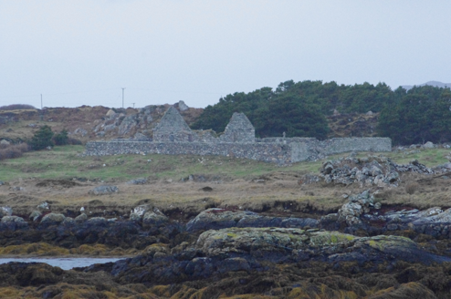
Teampall Cróine [Templecrone]Church/chapel · 1 yd

Explorer Tom Teampall Cróine [Templecrone] has stood roofless since c.1620, meaning it has spent four centuries staring straight up…
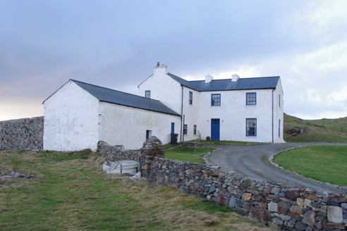
Termon HouseSteward's house · 764 yd

Explorer Tom Termon House, built around 1770, has a base that slopes outward, probably to throw rain away from its walls. A raindrop…

Portal tomb in An Roisín TheasPortal tomb · 987 yd

Explorer Tom Portal tomb in An Roisín Theas has lost a few bricks since an artist sketched it back in the 1790s. It’s tucked into a…
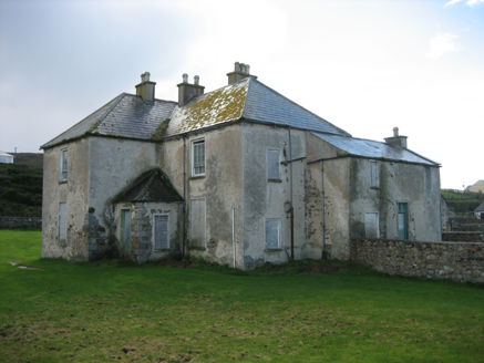
The RectoryRectory/glebe/vicarage/curate's house · 1056 yd

Explorer Tom The Rectory in Maghery Glebe was built around 1825 and looks toward Maghery Bay. If I had a desk full of paperwork…

Strand View BarPub · 1092 yd

Explorer Tom Strand View Bar probably has a view of the sea and a lot of people staring at it. It's in Donegal, where the wind tries…

EadarinisIslet · 1.1 mi

Explorer Tom Eadarinis is so small that if you sneeze too hard, it might actually jump into the next county for a holiday. Its…

Inis FraoighIsland · 1.2 mi

Explorer Tom Inis Fraoigh is the larger Inishfree Island between Dungloe and Burtonport, where families once farmed and fished. I…

Crohy TowerSignal tower · 1.2 mi

Explorer Tom Crohy Tower was built around 1805 as part of a coastal signal network watching for a possible French invasion. I would…

Lop 74Watch tower · 1.3 mi

Explorer Tom Lop 74 was a small coast watch hut erected around 1941, with a canted western half and a fireplace. From its elevated…

Lough Aghnish Promontory FortPromontory fort, inland · 1.5 mi

Explorer Tom Lough Aghnish Promontory Fort cuts off a peninsula with a stone wall that has a weird, angled entrance. The base is…

An Claondoire Burial Cairn above Lough AghnishCairn, burial cairn · 1.5 mi

Explorer Tom An Claondoire Burial Cairn above Lough Aghnish covered much of a steep hilltop when surveyed. It had several old…

CroaghnamaddyMountain / peak · 2.2 mi

Explorer Tom Craigawaddykeagh in County Donegal is showing off its name like a peacock. If it won the lotto, it’d buy a bigger hat…

More historic places in County Donegal · All of County Donegal

Add to this placeAdd a picture Add a detailed tip Add a story

Explore the map1,095,414 places to discover

Next place · or swipeTeampall Cróine [Templecrone]