
What is recorded here
From OpenStreetMap (© OpenStreetMap contributors) n6605646113
Places near here
Picture notes
- Computer-made picture. It does not show this monument.
- Computer-made picture. It does not show this mountain top.
- Mike Searle, Geograph · CC BY-SA 2.0
- Vadim Manuylov, Wikimedia Commons · CC BY-SA 3.0
- Algirdas at Lithuanian Wikipedia, Wikimedia Commons · Public domain
- National Inventory of Architectural Heritage
- Computer-made picture. It does not show this garden.
- GerryGunnigan, Wikimedia Commons · CC BY-SA 4.0
- Garry Dickinson, Wikimedia Commons · CC BY-SA 2.0
- Mike Searle, Wikimedia Commons · CC BY-SA 2.0
 Mound in Emo ParkMound · 776 ydComputer-made picture
 Lough HillMountain / peak · 957 ydComputer-made picture
 Emo CourtFolly · 971 yd
Explorer Tom The Emo Court folly is basically a fancy garden toy from the eighteenth century. When nobody’s looking, it’s probably plotting its own slow collapse into the earth. Bring your worst joke, the place has heard worse.
 Holme's HillMountain / peak · 1304 ydComputer-made picture
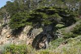 Monterey Cypress1699 yd
Explorer Tom Monterey Cypress in County Laois nearly became famous for looking like a wizard who forgot his hat. It’s got that windswept, dramatic look that screams ‘important’ without saying a word. It's the kind of place that makes a dull Tuesday interesting.
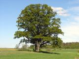 Pedunculate Oak1714 yd
Explorer Tom Pedunculate Oak in County Laois was nearly sold to a farmer as a replacement horse because nobody could tell the difference at a distance. The farmer was very confused when it didn’t gallop. Find the date carved somewhere and feel clever.
 Fairy fort / earthen ringfort in GarryvacumFairy fort / earthen ringfort · 1.2 miComputer-made picture
Explorer Tom Fairy fort / earthen ringfort in Garryvacum claims it’s older than the hills, which is probably a lie. It was once mislabeled as a battlefield, so imagine the confusion. Ideal spot for a dramatic phone call.
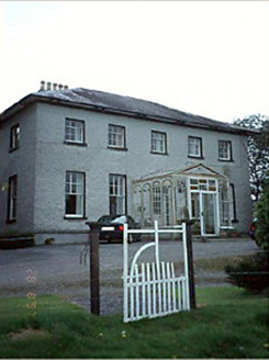 Huntington HouseCountry house · 1.2 mi
Explorer Tom Huntington House would walk into a job interview and say, 'I have a glazed porch and a stable complex, what do you need?' It’s playing hard to get in that late-Georgian suit. Bring your nan, she'll know more than me.
 Emo Court Walled GardensGarden · 1.2 miComputer-made picture
 The SpireFolly · 1.3 mi
Explorer Tom The Spire in Ballymorris is a folly that screams 'look at me' from the hilltop. It makes a weird whistling sound when the wind blows through those blind loops. Perfect spot to practise your best tour-guide voice.
 Tinnakill Castle (in Ruins)Castle, tower house · 2.4 mi
 Lea Castle (in ruins)Castle, Anglo-Norman masonry castle · 3.0 mi
Explorer Tom Lea Castle has circular angle towers that look like they’re winking at you. A fox took charge last Tuesday and seemed to enjoy the view. Tell it a joke, it's been a long time since anyone did.
More mountains and hills in County Laois · All of County Laois

What do you know about this place?Tap to add a comment or ask a question