Places near here
Photo credits
- National Inventory of Architectural Heritage
- Willow, Wikimedia Commons · CC BY 2.5
- Graham Horn, Geograph · CC BY-SA 2.0
- Sgbrito at Portuguese Wikipedia, Wikimedia Commons · Public domain
- Sheila1988, Wikimedia Commons · CC0
- Mike Searle, Geograph · CC BY-SA 2.0
Explorer Tom Tullymagawly bawn would order a large chipper with extra vinegar and sit in the corner judging everyone else. It’s the last seat of a family that probably just wanted to chill out in peace. Pretend you're a lost aristocrat, nobody will check.
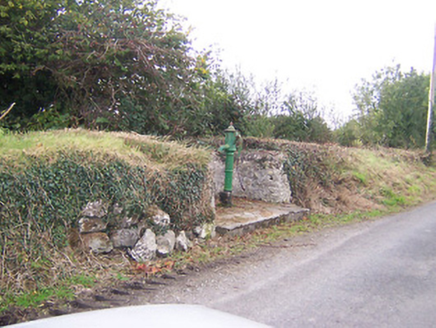 water pump991 yd
Explorer Tom Water pump in Tully is actually run by a very serious terrier who demands biscuits. He's been guarding it since 1890 and hasn't blinked once! Offer him a treat or he'll make the water taste like regret.
Ecclesiastical enclosure in FassaghEcclesiastical enclosure · 1315 ydExplorer Tom Ecclesiastical enclosure in Fassagh is just a graveyard wall pretending to be holy, which works until you realize it’s mostly made of bad jokes and old stones that don’t care about your sins. It would tell you everything after a few pints, but it’s currently too drunk on history to form coherent sentences. Go with someone who loves old stuff and watch them melt.
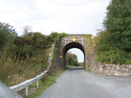 bridge1560 yd
Explorer Tom Bridge in Tully would write on its dating profile: 'Robust, reliable, and currently single since 1987.' It’s a railway bridge that never got to catch any trains anymore, just watching the grass grow tall. Tip your hat to it or it might frown at you all day.
Dotted outlineFairy fort / earthen ringfort · 1.1 miExplorer Tom Killogeenaghan Dotted Outline is just a ghost on the map that never quite materialized into anything solid, like a bad dream you can’t shake off. It’s got no real substance, just vibes and a bit of earthy confusion. Go on, count the windows and get it wrong like I did.
Moydrum Castle WoodlandForest · 1.9 miExplorer Tom Moydrum Castle Woodland has an imaginary twin across the sea that sends it postcards every year. It’s all very dramatic and full of unrequited love for distant shores. Stand still and listen, the wind tells it better than me.
 European ash3.9 mi
Explorer Tom European ash in County Westmeath is standing tall after a local priest lost a bet about how many leaves it has and now refuses to speak to him. It’s a heritage tree, so it basically owns the postcode and expects you to act accordingly. Tell your mates you found it first.
Temple's IslandIslet · 4.5 miExplorer Tom Temple's Island claims it survived a massive storm by holding its breath and refusing to sink. I believe it mostly because nobody has bothered to check if it’s actually there or just a rumour. It's free, it's odd, what more do you want?
 CastleCastle, unclassified · 4.9 mi
Explorer Tom Cox's Castle in Athlone makes a weird groaning sound at night, probably because it’s thinking about its past life. It used to be on St. George's Lane before getting lost in the shuffle of history. It’s got that ‘I was here’ energy but no receipt. Listen closely if you’re brave enough.
 Athlone CastleMuseum · 4.9 mi
Explorer Tom Athlone Castle has watched people try to cross the Shannon for so long it could charge for directions. A wooden fort stood here in 1129 under Tairrdelbach Ua Conchobair. In 1210 Bishop John de Gray built a stone castle for King John, planting a polygonal tower beside the bridgehead. That central keep still survives, though later centuries have changed it enough to keep a guide busy. I would have added a sign saying which king paid for which wall, but medieval builders rarely thought of my convenience. The fortification became a museum in 1967 and later gained a larger visitor centre, so the old crossing is now a place to stop rather than defend. This is a managed attraction with current tickets and opening hours; check them before arriving. Look from the keep toward the river. The Shannon is still doing the job that made everybody want this spot.
 Luan GalleryGallery · 5.0 mi
Explorer Tom Luan Gallery is hiding a massive scandal from three centuries ago involving a missing hat. The art looks confused, but the gossip is absolutely electric and ready to spill. Practise your Irish on it, it won't correct you.
 Historic Town - Athlone Castle & Church of St Peter and PaulVisitor information · 5.0 mi
Explorer Tom Whoever built Athlone Castle was clearly thinking about how to make the church look good in bad weather, which is oddly specific genius. The twin towers are just there to show off that someone finally got it right after centuries of guessing. Make up your own legend and I'll swear it's true.
More archaeology and monuments in County Westmeath · All of County Westmeath

What do you know about this place?Tap to add a comment or ask a question