What is recorded here
Situated on top of a natural rise, on the SSE side, in gently undulating, rough pasture. Possibly the remains of a ringfort that was modified as a tree-ring in the post-1700 period. The monument is visible on Digital Globe photography as a roughly oval-shaped area defined by trees. Depicted on the 1837 ed. OS 6-inch map as a roughly oval-shaped tree-planted enclosure. Depicted on the revised 1913 ed. OS 25-inch map as a roughly D-shaped tree-planted enclosure (approx. dims. 26m ENE-WSW; 25m NNW-SSE) with straight side at N. Monument described in 1971 as a roughly circular-shaped area (dims. 22m NW-SE; 19m NE-SW) defined by a bank which has been reduced to a scarp. The bank and scarp were modified at a later date from SE-S-W-N. The original entrance is not visible and there is no visible trace of a fosse. A gentle, modern bank of earth and stone defines the exterior from N-E-ESE. The interior has a gentle SSE-facing slope with vague remnants of cultivation ridges (long-axis NNW-SSE).
See attached profile of monument surveyed and drawn by the ASI
Compiled by: Alison McQueen, Vera Rahilly and Caimin O’Brien
Date of upload: 03 December 2018
This remains an important historical record, but the official description says the monument is no longer visible or has been destroyed. The monument record does not grant public access. Check the route and ask the landowner before entering private land.
- What survives
- No visible remains or recorded as destroyed
Places near here
 IndicatedFairy fort / earthen ringfort · 617 yd
 gates/railings/wallsgates/railings/walls · 976 yd
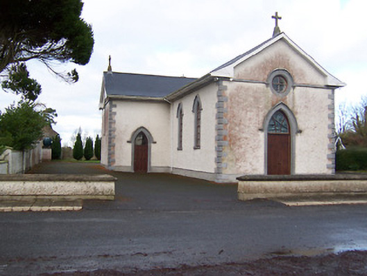 Saint Patrick's Catholic Churchchurch/chapel · 1229 yd
 Partially hachuredFairy fort / earthen ringfort · 1575 yd
 Hachured, 420 ODCastle, motte · 1.9 mi
 Site of CastleCastle, unclassified · 1.9 mi
 Sessile OakSessile Oak · 2.2 mi
 Ancient Ring FortWood · 2.8 mi
 Abbeyshrule AbbeyRuins · 3.6 mi
 Craft WorkshopHeritage attraction · 4.5 mi
 Guest ServicesVisitor information · 4.5 mi
 Goldsmith Birthplace, PallasVisitor information · 4.8 mi
Other information
Photo: Credit not shown in the picture search · Rights wording not checked; contact us if this picture should be removed