What is recorded here
In dense gorse on the lower NW-facing slope of Grange Hill at 91m OD. The cave penetrates a limestone knoll and is located at almost the highest point in the local landscape with panoramic views to the SW, W and NW. An enclosure (LI023-062----) lies 15m to SE and a standing stone (LI023-109----) 70m to W. Lough Gur…
Read the whole record
From the National Monuments Service (Archaeological Survey of Ireland) record LI023-240
Places near here
Photo credits
- National Inventory of Architectural Heritage
- Maker not stated on source page, www.alamy.com
- Maker not stated on source page, www.pinterest.com
- Maker not stated on source page, www.tripadvisor.ca
- Maker not stated on source page, www.freepik.com
- No machine-readable author provided. Christian1965~commonswiki assumed (based on copyright claims)., Wikimedia Commons · Public domain
 Sixmile BridgeBridge · 1016 yd
Explorer Tom Sixmile Bridge once saw a dramatic horse-drawn carriage crash into its stone side, or so the legend goes. It’s a large…
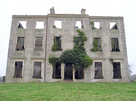 The GrangeCountry house · 1282 yd
Explorer Tom The Grange in Grange has a ghost that’s too lazy to haunt the ruins properly, just napping on the steps. It’s all…
 Fairy fort / earthen ringfort in Grange (smallcounty By.)Fairy fort / earthen ringfort · 1335 yd
Explorer Tom Fairy fort / earthen ringfort in Grange is a wet pasture earthwork that Saint Patrick would have definitely called out…
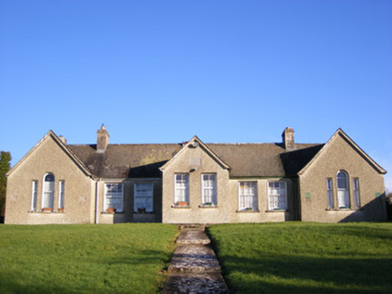 Grange National SchoolsSchool · 1374 yd
Explorer Tom Grange National Schools in Grange is still holding onto its separate entrances for boys and girls like it’s trying to…
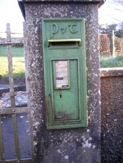 post box1377 yd
Explorer Tom Post box in Grange is sick of being asked if it’s still got the royal insignia. The Gaelic lettering says it’s moved on…
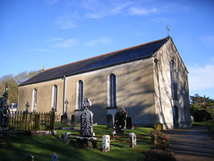 Catholic Church of Saint Patrick and Saint BrigidChurch/chapel · 1.0 mi
Explorer Tom Catholic Church of Saint Patrick and Saint Brigid would say in a job interview that it has strong references and…
 Loughgur HouseCountry house · 1.1 mi
Explorer Tom Loughgur House in Grange was nearly sold for a horse because the owner ran out of money. The new owners think that’s…
 Crock IslandArchaeological place · 1.1 mi
Explorer Tom Crock Island is giving Dublin tourists the silent treatment because they keep asking if it's a cruise destination. It’s…
 Stone CircleSettlement platform · 1.2 mi
Explorer Tom Stone Circle in Knockfennell is technically a lakeshore platform but everyone calls it a stone circle because circles…
 Stone circle in KnockfennellStone circle · 1.2 mi
Explorer Tom Stone circle in Knockfennell sits right by the water, swaying slightly as if it’s dancing to an invisible tune only the…
 Áine and Gearóid Iarla: Lough GurLegend location · 1.5 mi
Explorer Tom Áine and Gearóid Iarla: Lough Gur has a goddess for the lake and a sleeping lord in the old stories. I thought I was…
 Stone CirclesSettlement platform · 1.9 mi
Explorer Tom Stone Circles in Loughgur hates tourists who wear flip-flops because the mud is personal and extremely mean-spirited.…
More caves in County Limerick · All of County Limerick

What do you know about this place?Tap to add a comment or ask a question