What is recorded here
Grange National Schools gave boys and girls separate entrances; now it's a community hall. All that effort keeping them apart, just to have them meet again over a raffle prize neither of them wants.
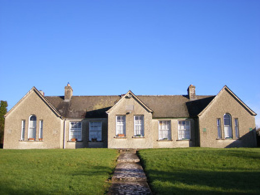
Detached seven-bay single-storey former national school, built in 1867. Comprising gable-fronted end bays and gable-fronted breakfront to front (west) elevation, single-bay single-storey extensions and gable-fronted extension to rear (east) elevation. Now in use as community hall. Pitched slate roof having render chimneystacks and cast-iron rainwater goods. Roughcast rendered walls with inscribed limestone plaque to breakfront. Tripartite openings to end bays having round-headed opening with flanking square-headed openings having one-over-one pane timber sliding sash windows and shared limestone sills. Square-headed openings with six-over-six pane timber sliding sash windows and limestone sills. Square-headed openings to breakfront having timber battened doors. Pair of square-profile concrete piers to west with cast-iron post box, single-leaf cast-iron gate and stile. Pair of square-profile concrete piers to south-west having single-leaf cast-iron gate.
An attractive, well proportioned former school, which despite a change of use retains its original external appearance. Features such as the sash windows and slate roof enhance the façade and help conserve the original aspect of the building. The separate entrances clearly articulate the classrooms for girls and boys, which were a common feature of the educational system in Ireland in the nineteenth century. Prominently sited this former school provides a pleasing roadside feature. Plaque reads: 'Grange National Schools Erected by S.F.W. de Salis Esq 1867'. The school was erected by John Francis William, 6th Count de Salis-Soglio, who was a British diplomat and coin connoisseur and lived between London and Grange Hill.
From the Buildings of Ireland (National Inventory of Architectural Heritage) record 21903203
This does not grant access. Most recorded buildings are privately owned; view them only from public ground unless the owner allows entry.
Places near here
Photo credits
- National Inventory of Architectural Heritage
- David Hawgood, Wikimedia Commons · CC BY-SA 2.0
- No machine-readable author provided. Christian1965~commonswiki assumed (based on copyright claims)., Wikimedia Commons · Public domain
- Martin Richard Phelan, Wikimedia Commons · CC BY-SA 2.0
- Oliver Dixon, Wikimedia Commons · CC BY-SA 2.0
- Oliver Dixon, Geograph · CC BY-SA 2.0
- Algirdas at Lithuanian Wikipedia, Wikimedia Commons · Public domain
- Martin Richard Phelan, Geograph · CC BY-SA 2.0
- Dylan Moore, Geograph · CC BY-SA 2.0
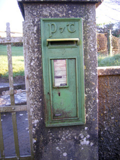 post box48 yd
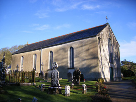 Catholic Church of Saint Patrick and Saint BrigidChurch/chapel · 576 ydBawn in Grange (smallcounty By.)Bawn · 868 yd
 Stone CirclesStone circle · 1007 yd
 Lough GurVisitor information · 1087 yd
 Grange Stone circleVisitor information · 1089 yd
 Stone CirclesStone circle, embanked · 1120 ydGarret IslandCastle, unclassified · 1310 yd
 The SpectaclesVisitor information · 1.1 mi
 Pedunculate Oak1.1 mi
 Lough Gur Heritage CentreVisitor information · 1.2 mi
 KnockainyMountain / peak · 4.3 mi
More historic places in County Limerick · All of County Limerick
What do you know about this place?